


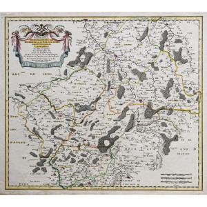
"Geographic Map Of Burgundy - Cassini"
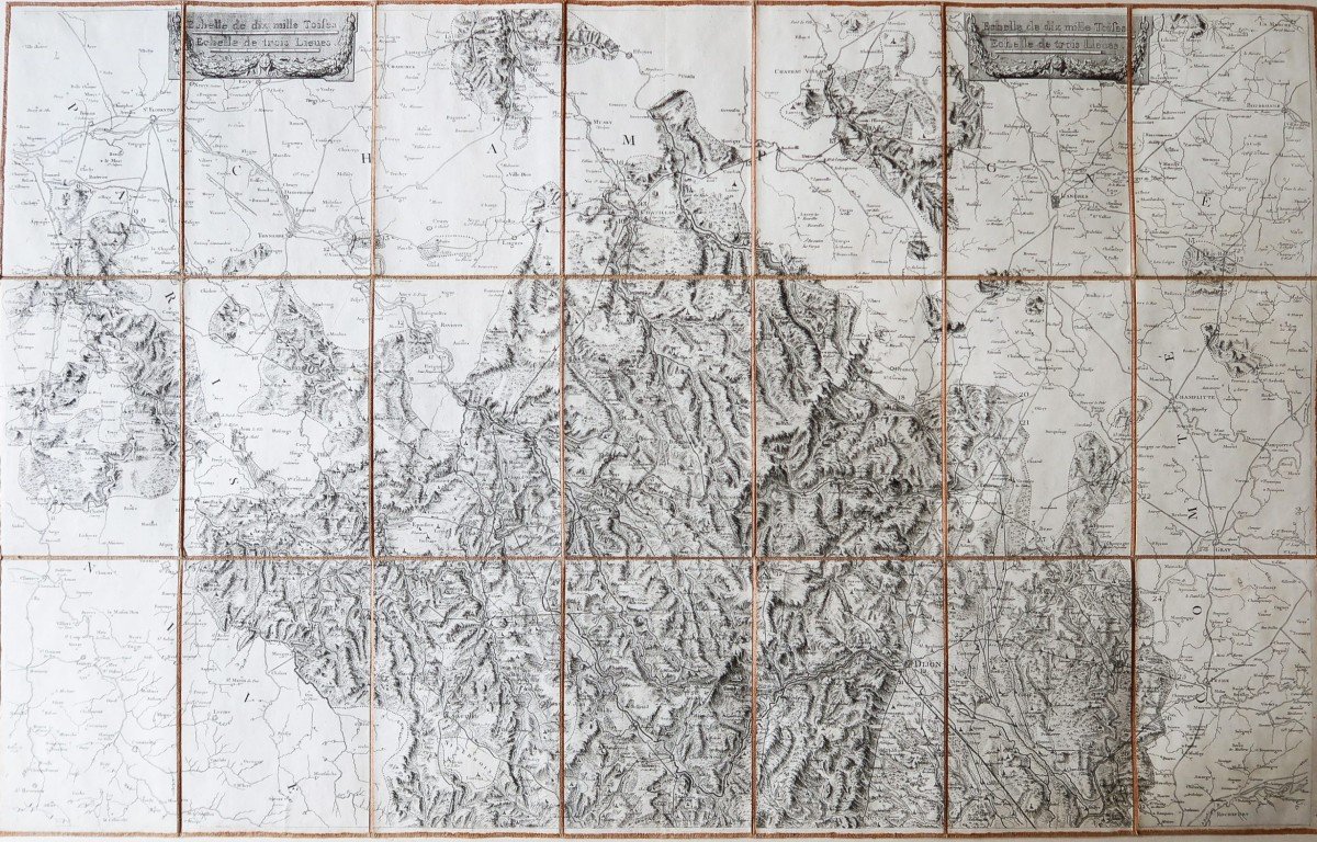
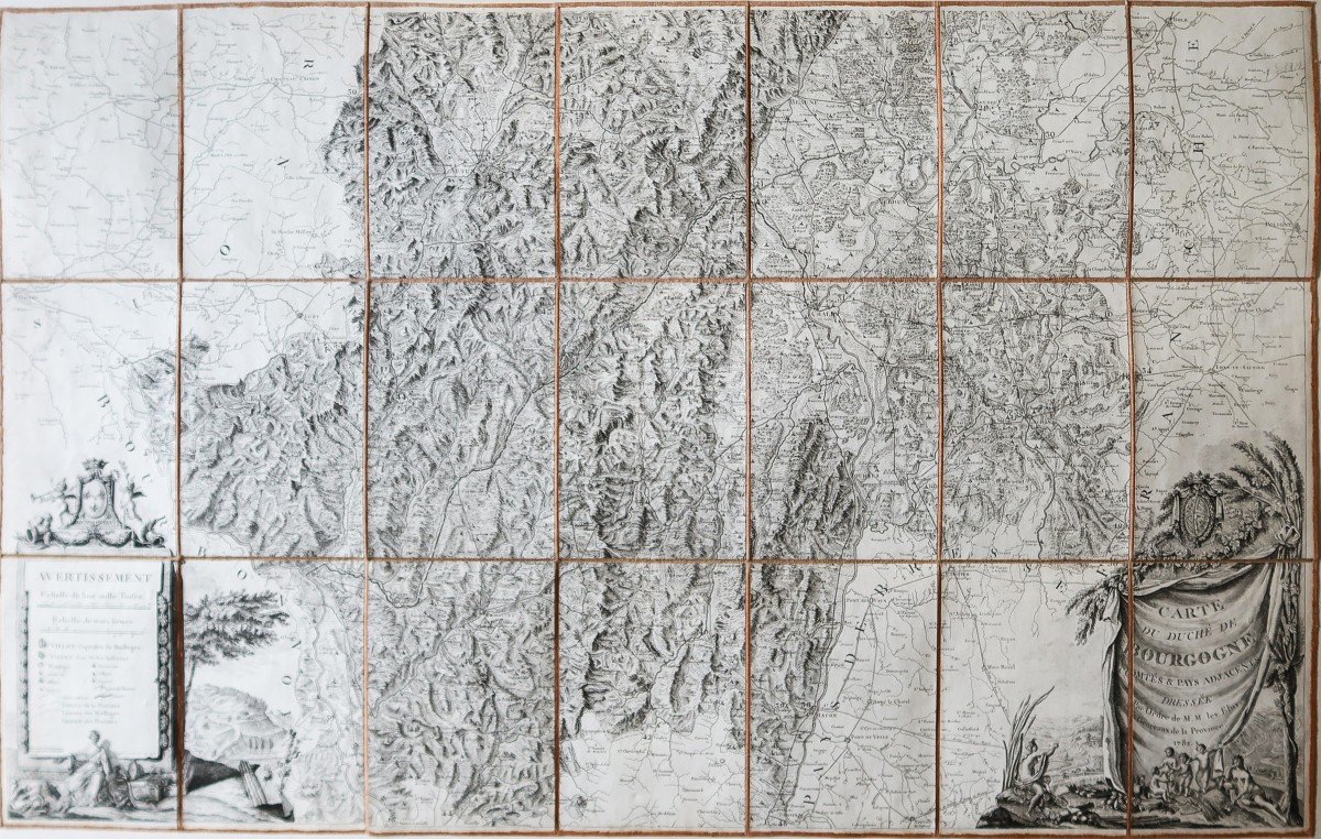
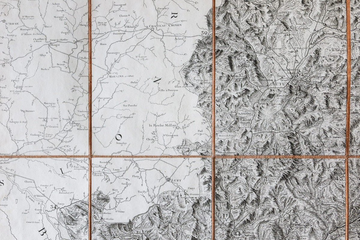
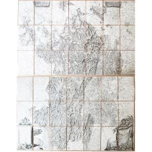
Grande Carte du duché de Bourgogne, Comtés & pays adjacents dressée par les élus généraux de la Province.Double cartes originales de Cassini réalisées en 1782.
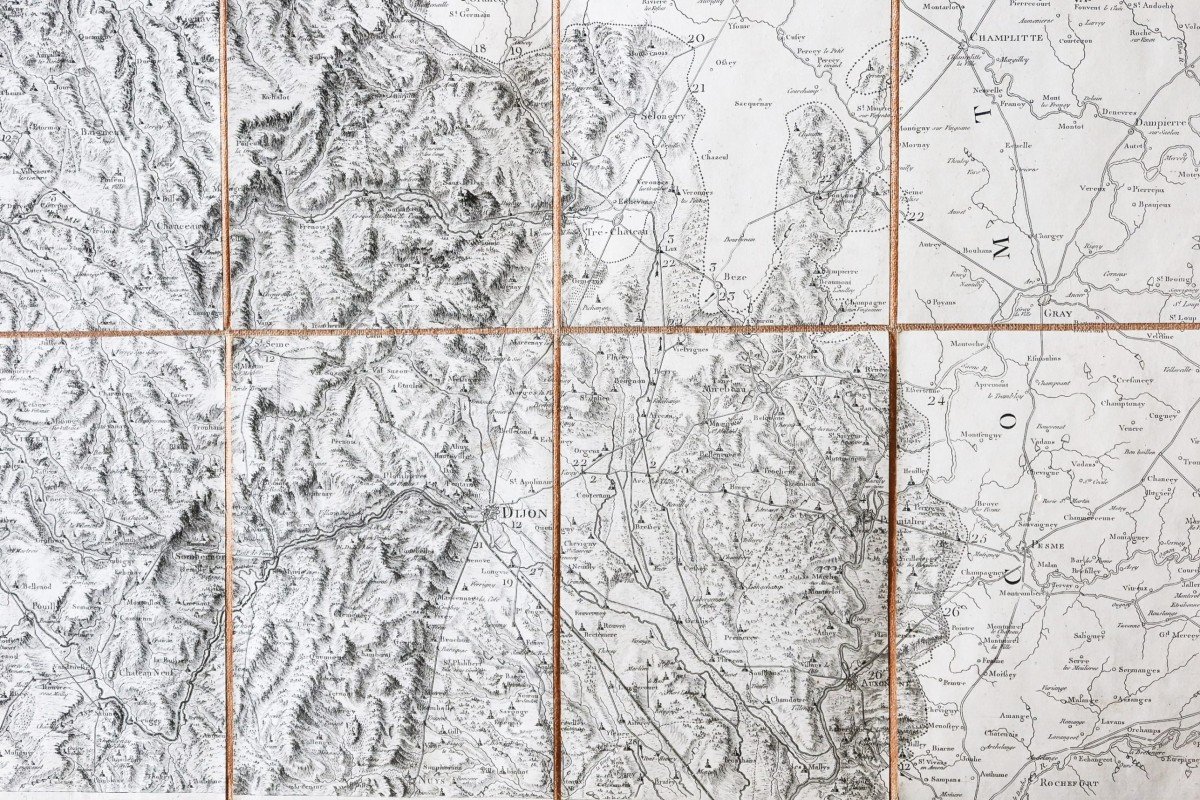
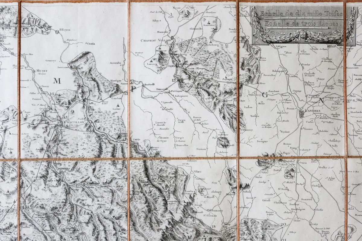
Entoilées d’époque et montées en 21 sections.
Les 2 cartes s’assemblent parfaitement.
Très bon état.
Format feuille : 99 x 62,5 cm x 2.
Format repliée : 21 x 14 cm x 2.
Très belle impression bien contrastée pour cette double carte ornée de 2 cartouches, 1 de titre et le second expliquant la signalétique des villes, bourgs et paroisses ; 2 encarts décoratifs dans la partie supérieure indiquent l’échelle des mesures en toises et en lieux.
Vous pouvez consulter l’ensemble des cartes, livres et gravures disponibles sur votre région en cliquant sur le lien de notre site internet spécialisé en archives anciennes géographiques:
https://cartes-livres-anciens.com/categorie-produit/cartes-geographiques-anciennes-original-antique-maps/france/bourgogne-franche-comte/
Règlement sécurisé par carte bancaire sur notre site internet en cliquant sur le lien ci-dessous:
https://cartes-livres-anciens.com/produit/cartes-geographiques-anciennes-original-antique-maps/france/bourgogne-franche-comte/carte-originale-de-cassini-la-bourgogne/
La Bourgogne, divisée en diocèses, baillages et subdélégations, avait été commandée par les États provinciaux du duché de Bourgogne, dans le cadre de la réalisation de la carte de France de Cassini.
En effet, Louis XV avait exprimé la volonté de faire établir une Carte générale de la France et avait confié cette mission à Cassini de Thury.
Les Cassinis, car César-François fut relayé à sa mort par son fils Jean-Dominique, s’en acquittèrent de manière remarquable sur près de 50 ans, en établissant la première carte générale et particulière du royaume.
Du point de vue cartographique, la première à s’appuyer sur une triangulation géodésique.
Certains États provinciaux dont la Bourgogne qui, la première proposa à Cassini de faire dresser eux-mêmes les cartes particulières de leur région, ce qui intéressa évidemment le cartographe. D’ailleurs ces cartes particulières sont supérieures, par la forme et le fond, aux autres cartes classiques des régions de France.
Toutes nos cartes et gravures sont accompagnées d’un certificat d’authenticité.
Large Map of the Duchy of Burgundy, Counties & adjacent countries drawn up by the elected generals of the Province. Double original Cassini maps made in 1782. Period canvas and mounted in 21 sections. The 2 cards fit together perfectly. Very good state. Sheet format: 99 x 62.5 cm x 2. Folded format: 21 x 14 cm x 2. Very nice, well-contrasted print for this double card adorned with 2 cartridges, 1 title and the second explaining the signage of towns, villages and parishes; 2 decorative inserts in the upper part indicate the scale of measurements in fathoms and places. You can consult all the maps, books and engravings available in your region by clicking on the link of our website specializing in old geographic archives: https://cartes-livres-anciens.com/categorie-produit/cartes-geographique -anciennes-original-antique-maps / france / bourgogne-franche-comte / Secure payment by credit card on our website by clicking on the link below: https://cartes-livres-anciens.com/produit/cartes -geographical-ancient-original-antique-maps / france / bourgogne-franche-comte / original-map-of-cassini-la-bourgogne / Burgundy, divided into dioceses, bailiwick and subdelegations, had been commissioned by the provincial states of duchy of Burgundy, as part of the production of Cassini's map of France. Indeed, Louis XV had expressed the desire to have a General Map of France drawn up and had entrusted this mission to Cassini de Thury. The Cassinis, because César-François was relayed to his death by his son Jean-Dominique, acquitted themselves in a remarkable way over nearly 50 years, by establishing the first general and particular map of the kingdom. From a cartographic point of view, the first to be based on a geodesic triangulation. Certain provincial states, including Burgundy, which was the first to suggest to Cassini that they themselves draw up the specific maps of their region, which obviously interested the cartographer. Moreover, these particular maps are superior, in form and content, to other classic maps of the regions of France. All our maps and engravings are accompanied by a certificate of authenticity.


 Le Magazine
 Rivista Artiquariato
 TRÉSORS magazine