

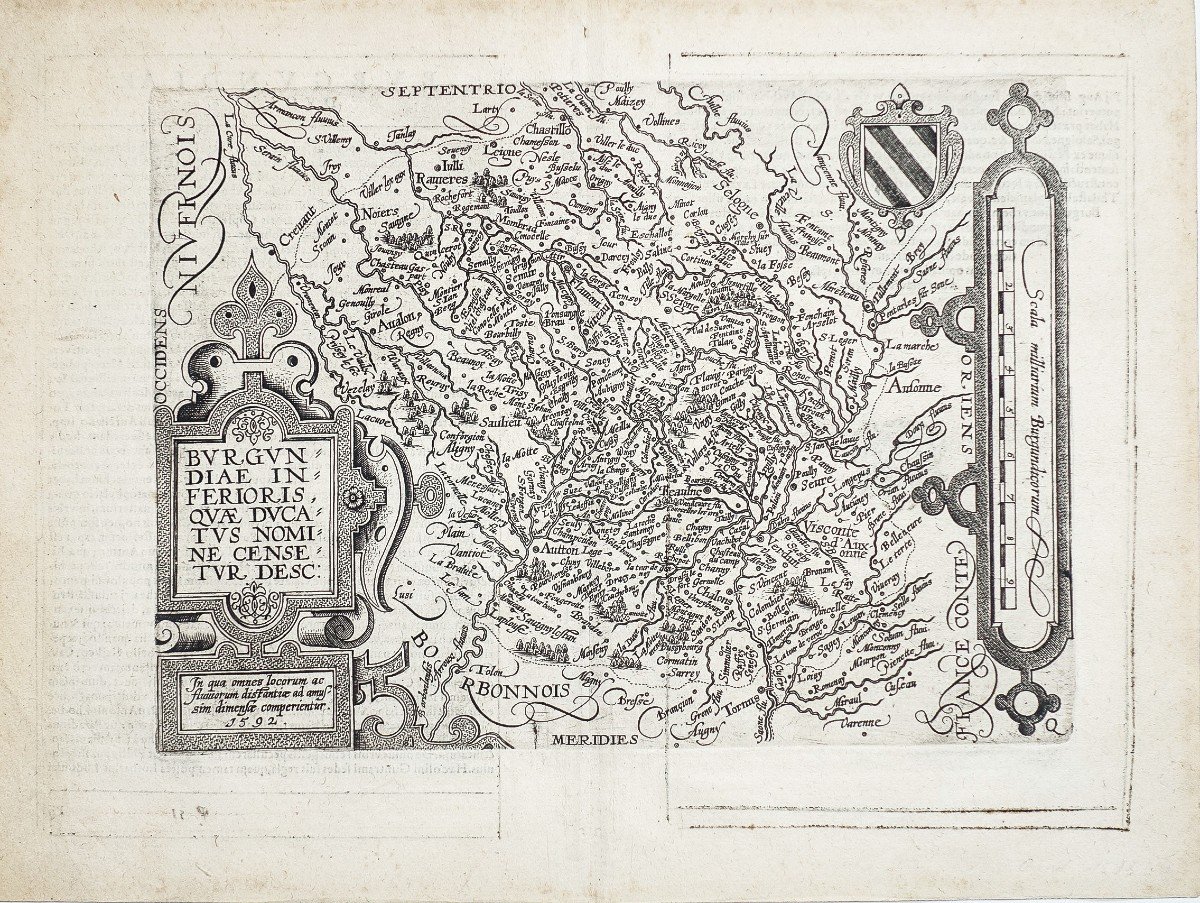

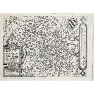


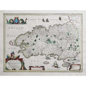
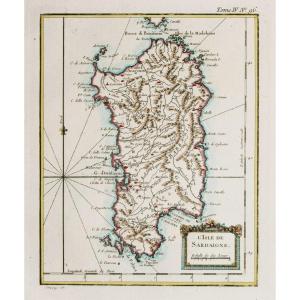
"Old Geographical Map - Alsace-bourgogne"
Alsace-Burgundiae in Ferioris Quae DucatusCarte originale gravée en 1596. Quad Matthias cartographe.
Texte explicatif en gothique au verso.
Très bon état.
Format feuille: 35 x 26 cm.
Format gravure: 26 x 19 cm.
Original antique map of 1596
Peu courant
Vous pouvez consulter l’ensemble des cartes et gravures disponibles sur votre région en cliquant sur le lien de notre site internet spécialisé en archives anciennes géographiques:
https://cartes-livres-anciens.com/categorie-produit/cartes-geographiques-anciennes-original-antique-maps/france/alsace-lorraine/
Règlement sécurisé par carte bancaire sur notre site internet en cliquant sur le lien:
https://cartes-livres-anciens.com/produit/cartes-geographiques-anciennes-original-antique-maps/france/alsace-lorraine/carte-geographique-ancienne-alsace-burgundiae-in-ferioris-quae-ducatus-original-antique-map/
Toutes nos cartes et gravures sont accompagnées d’un certificat d’authenticité.
Matthias Quad 1557 – 1613
Editeur de cartes basé à Cologne, a été formé aux Pays-Bas par Johannes van Doetecum, qui a également travaillé avec De Jode.
Quad a utilisé de nombreuses cartes De Jode comme base à laquelle il a ajouté des informations et des décorations supplémentaires.
En 1592, Quad a publié un atlas de l’Europe qui avait 38 cartes.Il l’a étendu en 1594 à 50 cartes.En 1600, il élargit encore la collection de cartes, cette fois à 82 cartes, et a appelé l’atlas,Geographisch Handtbuch.Tous trois étaient de petite taille, ce qui leur permettait de rivaliser comme alternatives moins chères aux grands atlas d’Ortelius, Mercator et De Jodes.
Alsace-Burgundiae in Ferioris Quae Ducatus Original map engraved in 1596. Quad Matthias cartographer. Explanatory text in Gothic on the back. Very good state. Sheet size: 35 x 26 cm. Engraving format: 26 x 19 cm. Original antique map of 1596 Uncommon You can consult all the maps and engravings available in your region by clicking on the link of our website specializing in ancient geographic archives: https://cartes-livres-anciens.com/categorie- product / old-geographic-maps-original-antique-maps / france / alsace-lorraine / Secure payment by credit card on our website by clicking on the link: https://cartes-livres-anciens.com/produit/cartes -geographical-ancient-original-antique-maps / france / alsace-lorraine / carte-geographique-ancien-alsace-burgundiae-in-ferioris-quae-ducatus-original-antique-map / All our maps and engravings are accompanied by a certificate of authenticity. Matthias Quad 1557 - 1613 Map editor based in Cologne, was trained in the Netherlands by Johannes van Doetecum, who also worked with De Jode. Quad used many De Jode maps as a base to which he added additional information and decorations. In 1592, Quad published an Atlas of Europe which had 38 maps. He extended it in 1594 to 50 maps. In 1600 he further expanded the collection of maps, this time to 82 maps, and called the atlas, Geographisch Handtbuch. All three were small in size, allowing them to compete as cheaper alternatives to the large atlases of Ortelius, Mercator and De Jode.


 Le Magazine
 Rivista Artiquariato
 TRÉSORS magazine