
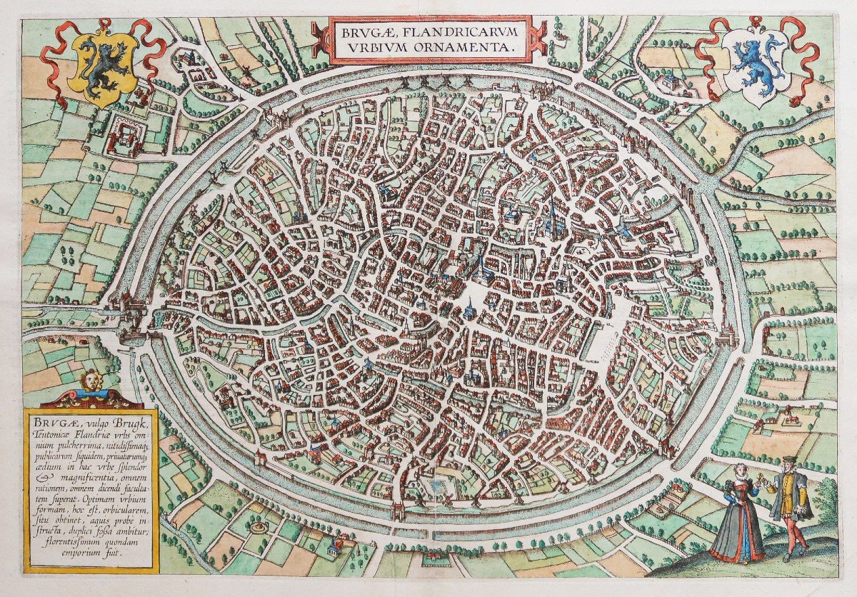
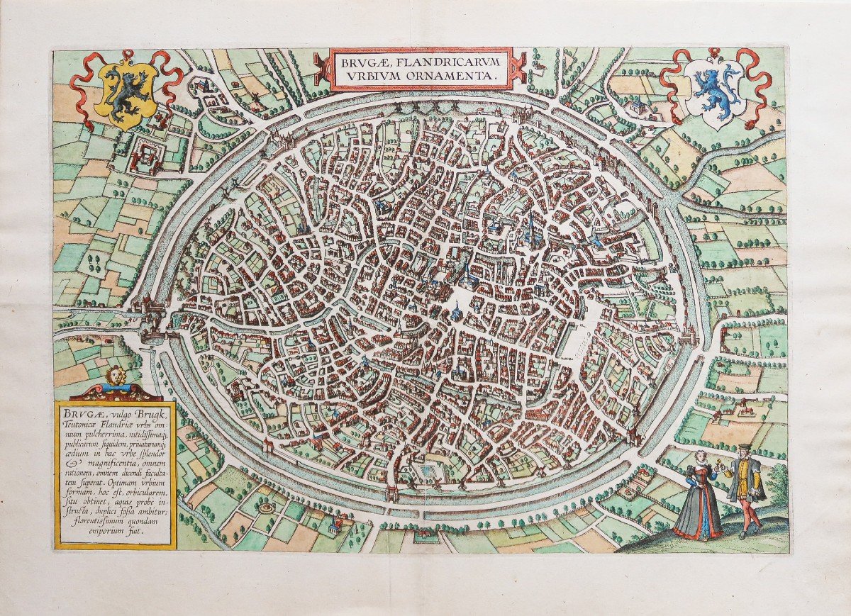


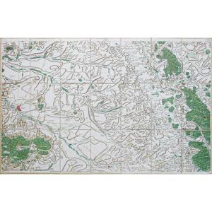
"Old Map Of Bruges"
Plan original gravé en 1595. Braun et Hogenbergcartographes.Beaux coloris aquarelle.
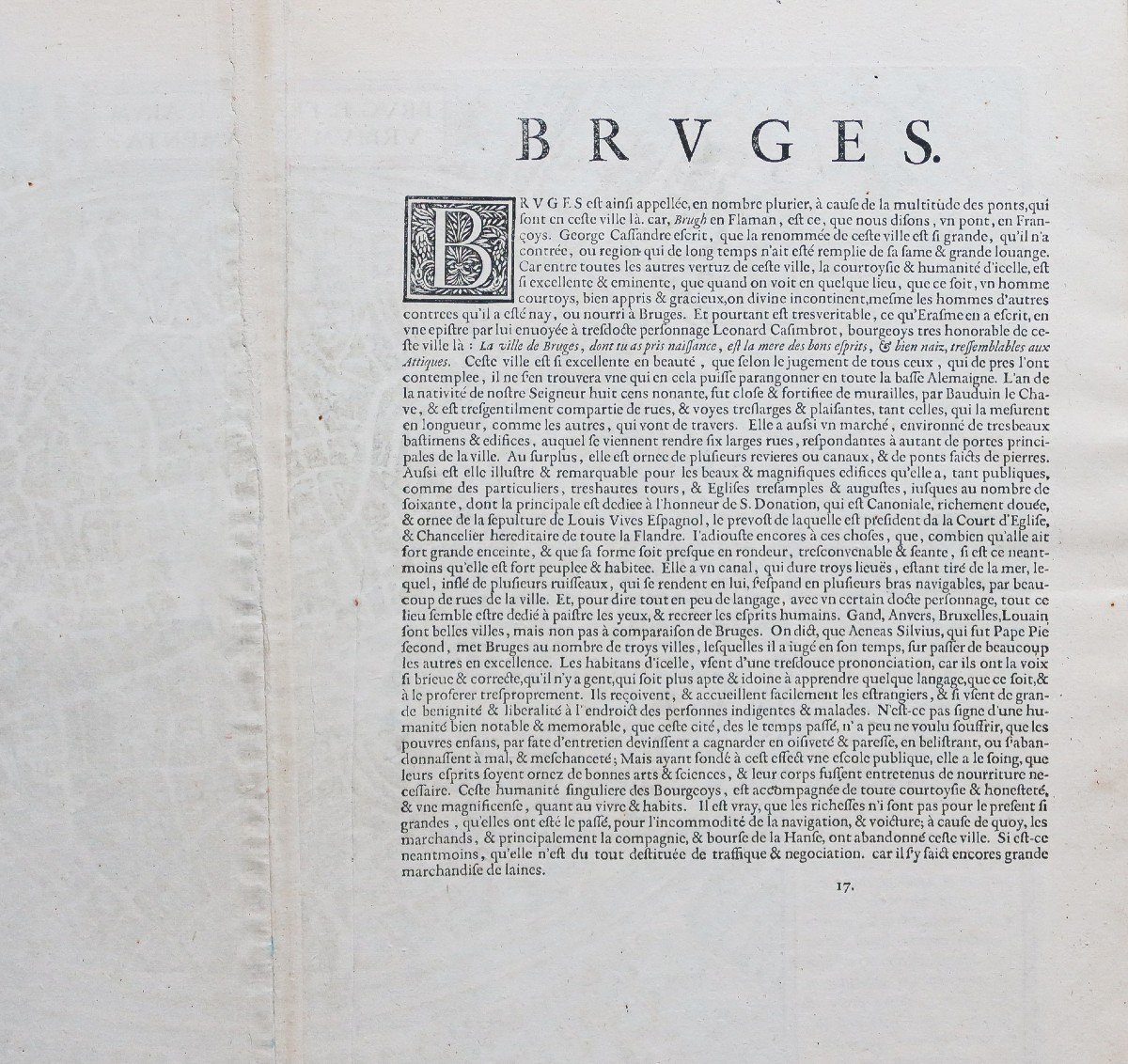
Texte explicatif en vieux français au verso.
Très bon état.
Format feuille : 52,5 x 38,5 cm.
Format gravure : 46 x 31,5 cm.
Original antique map of 1595.
L’une des premières représentations de la ville.
2 blasons décoratifs dans les angles supérieurs de l’épreuve.
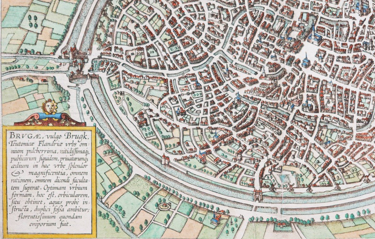
Cartouche explicatif.
Vous pouvez consulter l’ensemble des cartes, livres et gravures disponibles sur votre région en cliquant sur le lien de notre site internet spécialisé en archives anciennes géographiques:
https://cartes-livres-anciens.com/categorie-produit/cartes-geographiques-anciennes-original-antique-maps/europe/hollande-belgique-luxembourg/
Règlement sécurisé par carte bancaire sur notre site internet en cliquant sur le lien ci-dessous:
https://cartes-livres-anciens.com/produit/cartes-geographiques-anciennes-original-antique-maps/europe/hollande-belgique-luxembourg/plan-ancien-de-bruges/
Toutes nos cartes et gravures sont accompagnées d’un certificat d’authenticité.
Cette collectioncomprenait 564 cartes, vues à vol d’oiseau et plans detoutes les grandes villes d’Europe, ainsi que des villes les plus importantes d’Asie, d’Afrique et d’Amérique Latine. Dirigé et annoté parGeorg Braun, théologien et éditeur, largement illustré par les gravures du cartographeFranz Hogenberg., LeCivitatesa été conçu comme pendant à l’atlas universel d’Abraham Ortelius, leTheatrum Orbis Terrarum, publié en 1570. Plus d’une centaine d’artistes et de cartographes différents ont participé à cette somptueuse édition qui ne se contente pas de représenter les villes, mais offre également des éléments complémentaires : personnages en costumes locaux, bateaux, chariots à bœufs, scènes de cour, ou encore détails topographiques qui aident à rendre compte de la situation géographique, du pouvoir commercial et de l’importance politique des villes illustrées.
Original plan engraved in 1595. Braun and Hogenberg cartographers. Beautiful watercolor colors. Explanatory text in old French on the back. Very good state. Sheet size: 52.5 x 38.5 cm. Engraving format: 46 x 31.5 cm. Original antique map of 1595. One of the earliest representations of the city. 2 decorative coats of arms in the upper corners of the proof. Explanatory cartridge. You can consult all the maps, books and engravings available in your region by clicking on the link of our website specializing in ancient geographic archives: https://cartes-livres-anciens.com/categorie-produit/cartes-geographique -anciennes-original-antique-maps / europe / hollande-belgique-luxembourg / Secure payment by credit card on our website by clicking on the link below: https://cartes-livres-anciens.com/produit/cartes -geographical-ancient-original-antique-maps / europe / hollande-belgique-luxembourg / plan-ancien-de-bruges / All our maps and engravings are accompanied by a certificate of authenticity. This collection included 564 maps, bird's-eye views and plans of all the major cities of Europe, as well as the most important cities of Asia, Africa and Latin America. Directed and annotated by Georg Braun, theologian and publisher, extensively illustrated by engravings by cartographer Franz Hogenberg., The Civitates was conceived as a counterpart to Abraham Ortelius' universal atlas, the Theatrum Orbis Terrarum, published in 1570. More '' a hundred different artists and cartographers took part in this sumptuous edition which not only represents the cities, but also offers additional elements: characters in local costumes, boats, ox carts, court scenes, or even topographical details that help to capture the geographic location, commercial power, and political importance of the cities shown.


 Le Magazine
 Rivista Artiquariato
 TRÉSORS magazine