


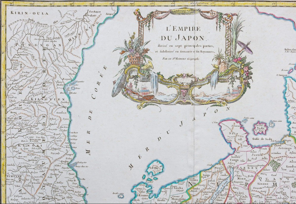
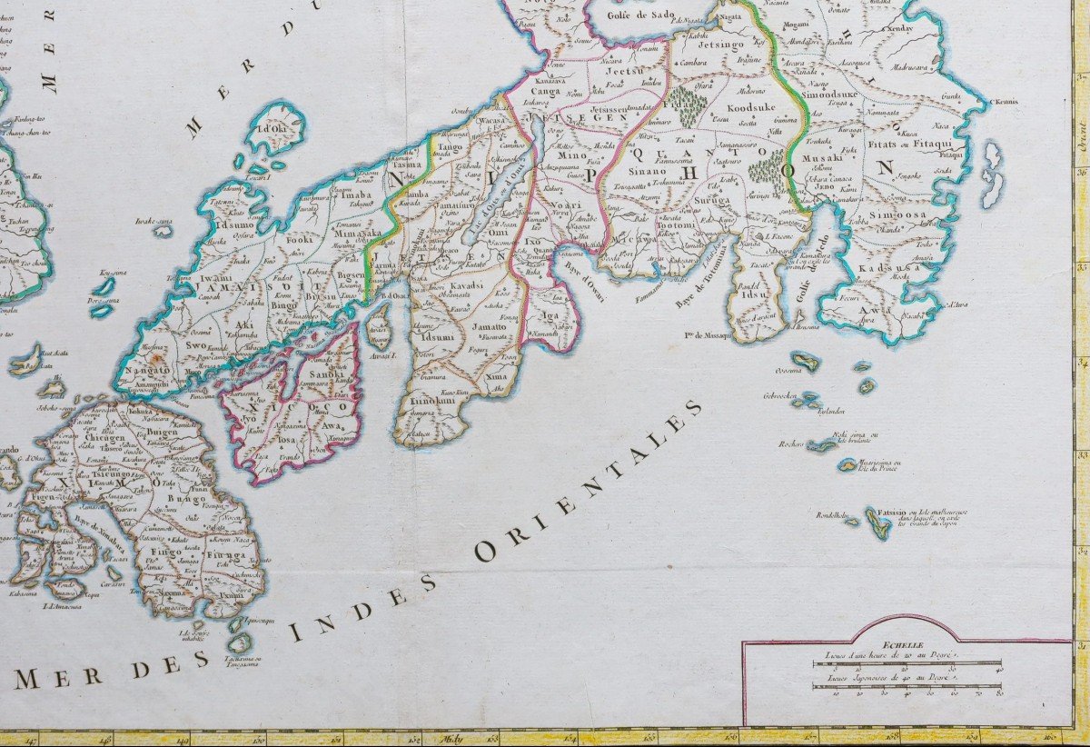


"Ancient Geographic Map Of Japan & Korea"
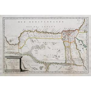
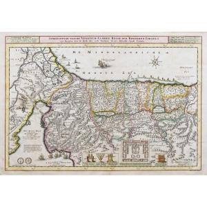
Divisé en sept principales parties, et subdivisé en soixante six Royaumes.Epreuve originale réalisée vers 1750. Seconde édition de 1790.
Robert de Vaugondy géographe.
Coloris aquarelle.
Très bon état.
Format feuille: 60 x 50 cm.
Format gravure: 56 x 49,5 cm.
Original antique map around 1750.
Carte particulièrement détaillée qui se concentre sur le Japon et une partie de la Corée.
Large cartouche de titre décoratif, échelle des lieues et séparation maritime intitulée mer du Japon et mer de Corée.
Vous pouvez consulter l’ensemble des cartes, livres et gravures disponibles sur votre région en cliquant sur le lien de notre site internet spécialisé en archives anciennes géographiques :
https://cartes-livres-anciens.com/categorie-produit/cartes-geographiques-anciennes-original-antique-maps/asie/japon/
Règlement sécurisé par carte bancaire sur notre site interneten cliquant sur le lien ci-dessous :
https://cartes-livres-anciens.com/produit/cartes-geographiques-anciennes-original-antique-maps/asie/japon/carte-geographique-ancienne-de-lempire-du-japon/
Toutes nos cartes et gravures sont accompagnées d’un certificat d’authenticité.
Gilles Robert de Vaugondy, ditRobert de Vaugondy, né en1688et mort en1766, est ungéographeetcartographe français.
Petit-fils deNicolas Sanson, il est nommé géographe du Roi. Il est le père du géographe et cartographeDidier Robert de Vaugondy(1723-1786), avec lequel il compose une collection de carte sur le Monde, parue en1757.
Divided into seven main parts, and further subdivided into sixty six Kingdoms. Original proof produced around 1750. Second edition of 1790. Robert de Vaugondy geographer. Watercolor colors. Very good state. Sheet size: 60 x 50 cm. Engraving format: 56 x 49.5 cm. Original antique map around 1750. Particularly detailed map that focuses on Japan and part of Korea. Large decorative title cartouche, leagues scale and maritime separation entitled Sea of Japan and Sea of Korea. You can consult all the maps, books and engravings available in your region by clicking on the link of our website specializing in ancient geographic archives: https://cartes-livres-anciens.com/categorie-produit/cartes-geographique -anciennes-original-antique-maps / asie / japon / Secure payment by credit card on our website by clicking on the link below: https://cartes-livres-anciens.com/produit/cartes-geographique-anciennes -original-antique-maps / asia / japan / carte-geographique-ancien-de-lempire-du-Japon / All our maps and engravings are accompanied by a certificate of authenticity. Gilles Robert de Vaugondy, known as Robert de Vaugondy, born in 1688 and died in 1766, is a French geographer and cartographer. Grandson of Nicolas Sanson, he was appointed geographer to the King. He is the father of the geographer and cartographer Didier Robert de Vaugondy (1723-1786), with whom he composed a collection of maps on the World, published in 1757.


 Le Magazine
 Rivista Artiquariato
 TRÉSORS magazine