

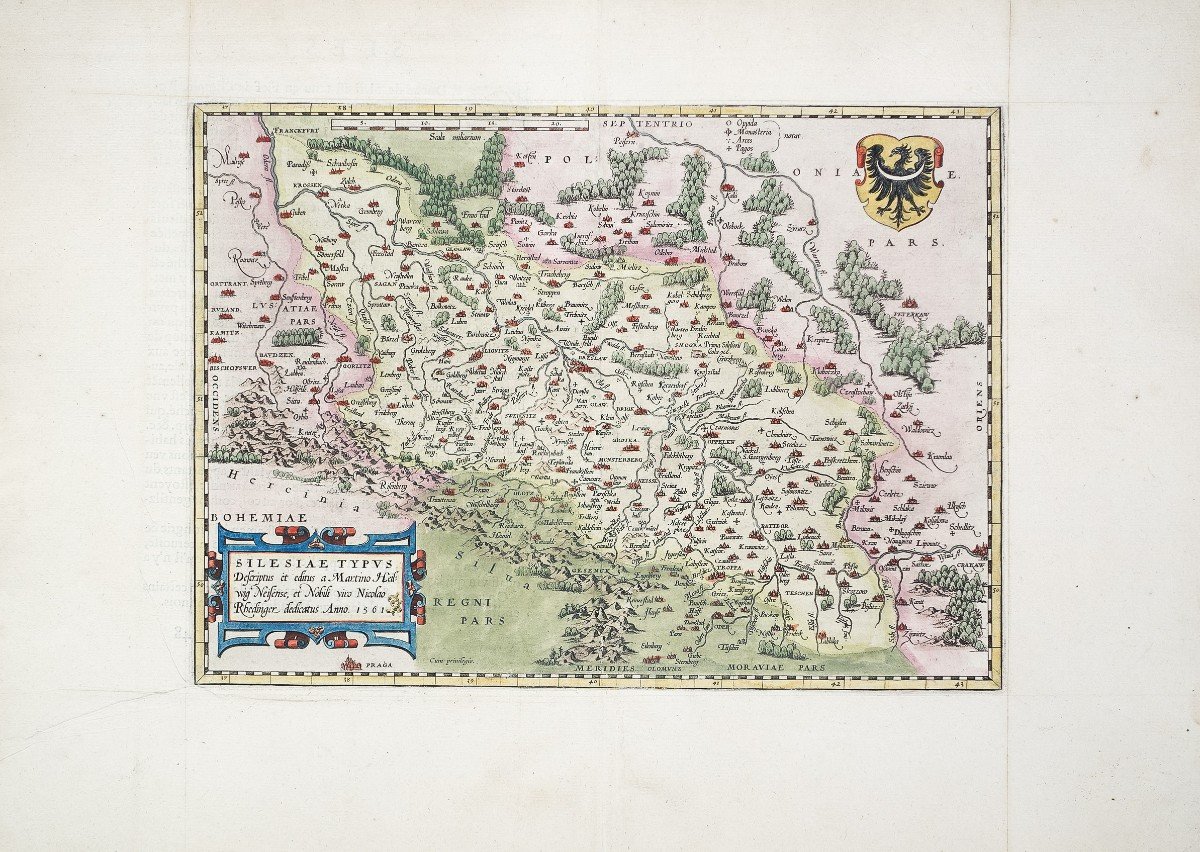


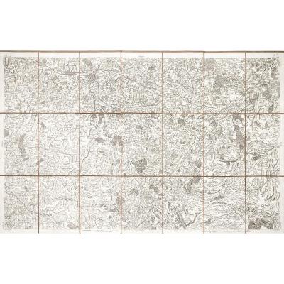
"Old Geographic Map Of Germany"
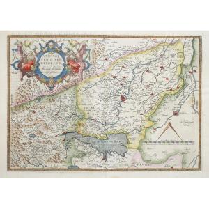
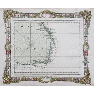
Carte originale gravée sur en 1581. Abraham Ortelius cartographe.Belle impression. Coloris aquarelle.
Explication de la carte en français au verso.
Format feuille: 61,5 x 43,5 cm.
Format cuivre: 39 x 28,5 cm.
Très bon état.
Original antique map of 1581
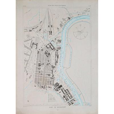
Importante carte de la Silèsie réalisée par Martin Heilwig en 1561 illustrée des armoiries de Silésie. Rare édition de 1581 avec un commentaire en vieux français au dos de la carte.
Vous pouvez consulter l’ensemble des cartes, livres et gravures disponibles sur votre région en cliquant sur le lien de notre site internet spécialisé en archives anciennes géographiques :
https://cartes-livres-anciens.com/categorie-produit/cartes-geographiques-anciennes-original-antique-maps/europe/allemagne/
Règlement sécurisé par carte bancaire sur notre site interneten cliquant sur le lien ci-dessous :
https://cartes-livres-anciens.com/produit/cartes-geographiques-anciennes-original-antique-maps/europe/allemagne/original-antique-map-allemagne-germany-carte-geographique-ancienne/
Toutes nos cartes et gravures sont accompagnées d’un certificat d’authenticité.
Abraham Ortel, mieux connu sous le nom d’Ortelius, est né à Anvers et, après avoir étudié le grec, le latin et les mathématiques, s’y est établi avec sa sœur, en tant que libraire et «peintre de cartes». Voyageant beaucoup, particulièrement aux grandes foires du livre, son entreprise prospéra et il noua des contacts avec des lettrés dans de nombreux pays.
Un tournant dans sa carrière est atteint en 1564 avec la publication d’une carte du monde en huit feuilles dont un seul exemplaire est connu : d’autres cartes individuelles suivront, puis, à la suggestion d’un ami, il rassemble une collection de cartes qu’ il fit graver dans une taille uniforme, formant ainsi un ensemble de cartes qui fut publié pour la première fois en 1570 sous le nom de Theatrum Orbis Terrarum (Atlas du monde entier).
Bien que Lafreri et d’autres cartographes italiens aient publié des collections de cartes «modernes» sous forme de livre au cours des années précédentes, le Theatrum a été la première collection systématique de cartes de taille uniforme et peut donc être appelé le premier atlas, bien que ce terme n’ait été utilisé vingt ans plus tard par Mercator.
Le Theatrum, avec la plupart de ses cartes élégamment gravées par Frans Hogenberg, connaît un succès immédiat et apparaît dans de nombreuses éditions dans différentes langues, y compris des addenda publiés de temps à autre incorporant les dernières connaissances et découvertes contemporaines. La dernière édition de cartes parut en 1612.
Contrairement à bon nombre de ses contemporains, Ortelius nota ses sources d’informations. Dans la première édition, quatre-vingt-sept cartographes étaient remerciés.
Outre les cartes modernes de son atlas principal, Ortelius a lui-même compilé une série de cartes historiques connues sous le nom de Parergon Theatri, qui sont apparues à partir de 1579, parfois sous forme de publication distincte et parfois incorporées au Theatrum.
Abraham Ortel, better known as Ortelius, was born in Antwerp and, after studying Greek, Latin and mathematics, settled there with his sister as a bookseller and «card painter».
Traveling a lot, especially at major book fairs, his business flourished and he made contact with scholars in many countries.
A turning point in his career was reached in 1564 with the publication of a map of the world in eight sheets of which only one copy is known: other individual cards will follow, then, at the suggestion of a friend, he gathers a collection of He engraved the cards in a uniform size, forming a set of cards that was first published in 1570 as the Theatrum Orbis Terrarum (Atlas of the World).
Although Lafreri and other Italian cartographers have published collections of «modern» cards in book form in previous years, the Theatrum was the first systematic collection of uniformly sized cards and can therefore be called the first atlas, although this term was used twenty years later by Mercator.
The Theatrum, with most of his cards elegantly engraved by Frans Hogenberg, is an immediate success and appears in many editions in different languages, including addenda published from time to time incorporating the latest knowledge and contemporary discoveries.
The last edition of cards appeared in 1612.Unlike many of his contemporaries, Ortelius noted his sources of information. In the first edition, eighty-seven cartographers were thanked.In addition to the modern maps of his main atlas, Ortelius himself compiled a series of historical maps known as Parergon Theatri, which appeared from 1579, sometimes as a separate publication and sometimes incorporated into the Theatrum.
Original map engraved on in 1581. Abraham Ortelius cartographer. Nice impression. Watercolor colors. Explanation of the map in French on the back. Sheet size: 61.5 x 43.5 cm. Copper format: 39 x 28.5 cm. Very good state. Original antique map of 1581 Important map of Silesia produced by Martin Heilwig in 1561 illustrated with the coat of arms of Silesia. Rare edition of 1581 with a commentary in old French on the back of the card. You can consult all the maps, books and engravings available in your region by clicking on the link of our website specializing in ancient geographic archives: Secure payment by credit card on our website by clicking on the link below: https : //cartes-livres-anciens.com/produit/cartes-geographique-anciennes-original-antique-maps/europe/allemagne/original-antique-map-allemagne-germany-carte-geographique-ancienne/ All our maps and engravings are accompanied by a certificate of authenticity. Abraham Ortel, better known as Ortelius, was born in Antwerp and, after studying Greek, Latin and mathematics, settled there with his sister, as a bookseller and "map painter". Traveling extensively, especially to major book fairs, his business flourished and he established contacts with scholars in many countries. A turning point in his career was reached in 1564 with the publication of a world map in eight sheets of which only one copy was known: other individual maps would follow, then, at the suggestion of a friend, he assembled a collection of maps which he had engraved in a uniform size, thus forming a set of maps which was first published in 1570 as the Theatrum Orbis Terrarum (Atlases of the whole world). Although Lafreri and other Italian cartographers had published "modern" map collections in book form in previous years, the Theatrum was the first systematic collection of uniformly sized maps and can therefore be called the first atlas, although this term was not used twenty years later by Mercator. The Theatrum, with most of its elegantly engraved maps by Frans Hogenberg, was an immediate success and appeared in numerous editions in different languages, including addenda published from time to time incorporating the latest contemporary knowledge and discoveries. The last edition of maps appeared in 1612. Unlike many of his contemporaries, Ortelius noted his sources of information. In the first edition, eighty-seven cartographers were thanked. In addition to modern maps from his main atlas, Ortelius himself compiled a series of historical maps known as Parergon Theatri, which appeared from 1579, sometimes as a separate publication and sometimes incorporated into the Theatrum. Abraham Ortel, better known as Ortelius, was born in Antwerp and, after studying Greek, Latin and mathematics, settled there with his sister as a bookseller and "card painter". Traveling a lot, especially at major book fairs, his business flourished and he made contact with scholars in many countries. A turning point in his career was reached in 1564 with the publication of a map of the world in eight sheets of which only one copy is known: other individual cards will follow, then, at the suggestion of a friend, he gathers a collection of He engraved the cards in a uniform size, forming a set of cards that was first published in 1570 as the Theatrum Orbis Terrarum (Atlas of the World). Although Lafreri and other Italian cartographers have published collections of "modern" cards in book form in previous years, the Theatrum was the first systematic collection of uniformly sized cards and can therefore be called the first atlas, although this term was used twenty years later by Mercator. The Theatrum, with most of his cards elegantly engraved by Frans Hogenberg, is an immediate success and appears in many editions in different languages, including addenda published from time to time incorporating the latest knowledge and contemporary discoveries. The last edition of cards appeared in 1612.Unlike many of his contemporaries, Ortelius noted his sources of information. In the first edition, eighty-seven cartographers were thanked. the Theatrum.


 Le Magazine
 Rivista Artiquariato
 TRÉSORS magazine