
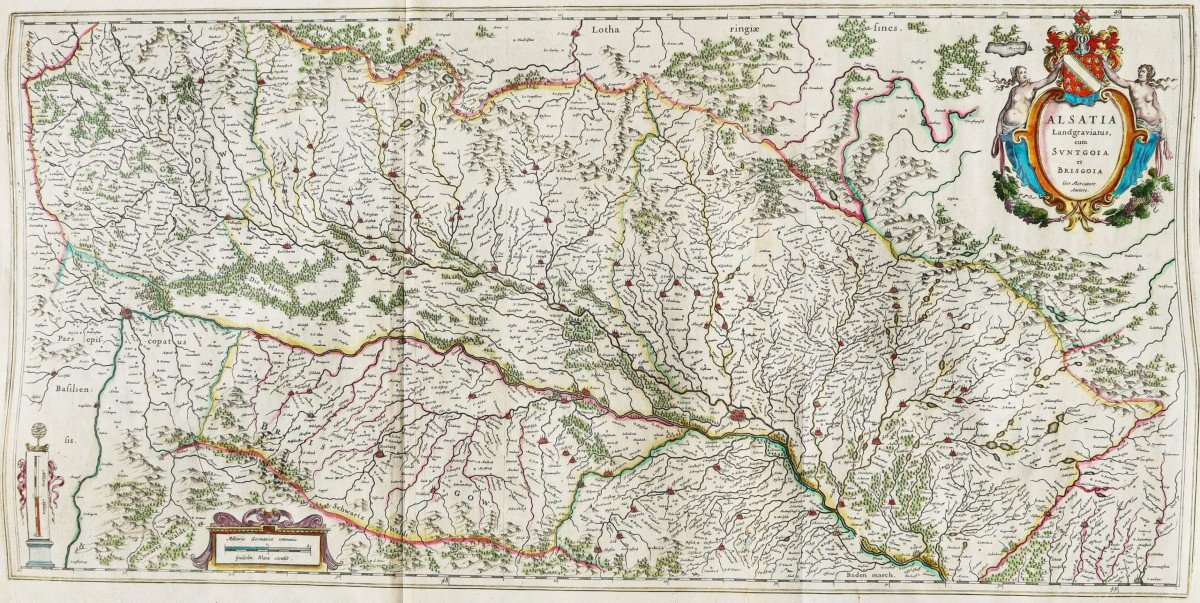
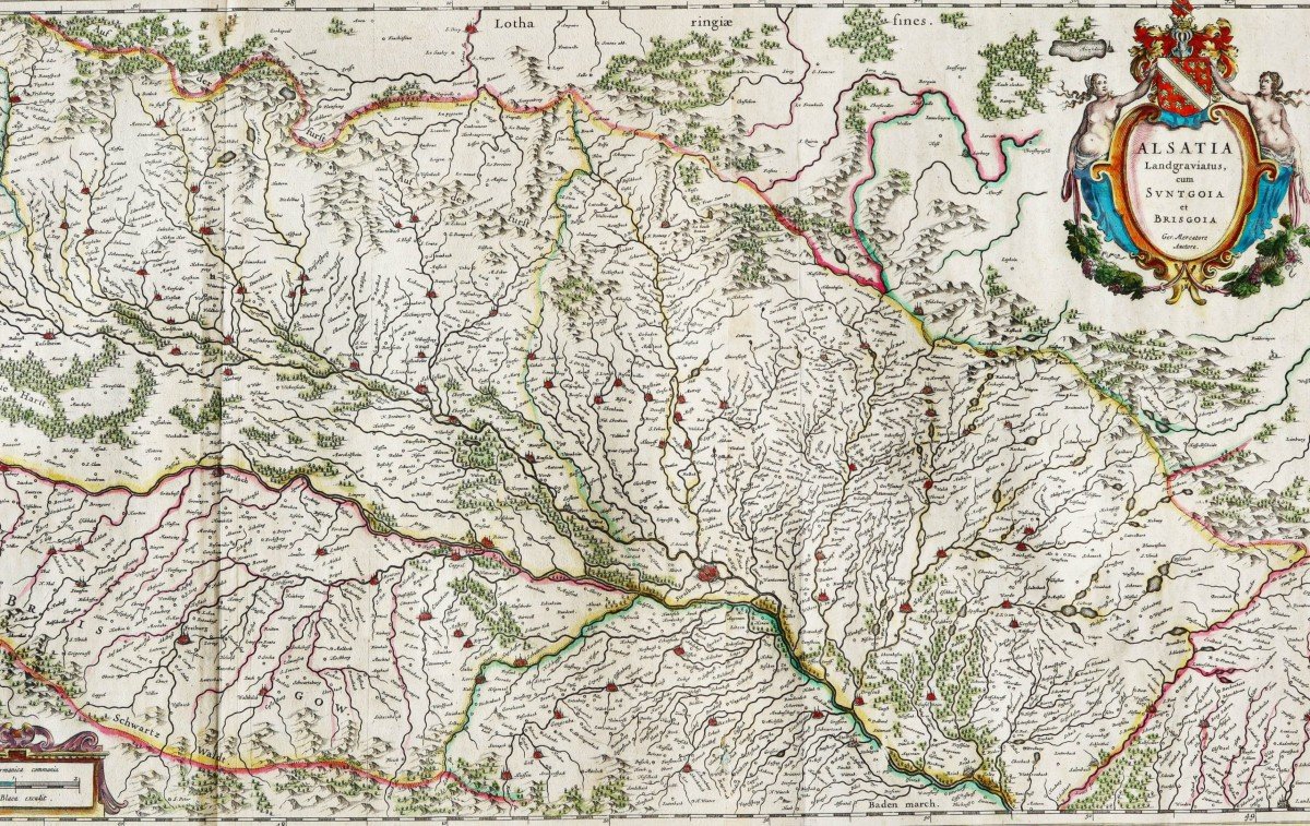
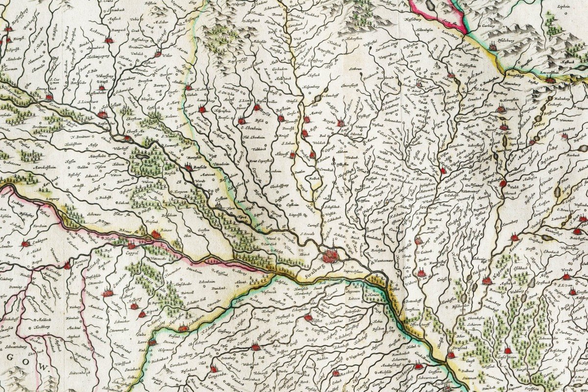
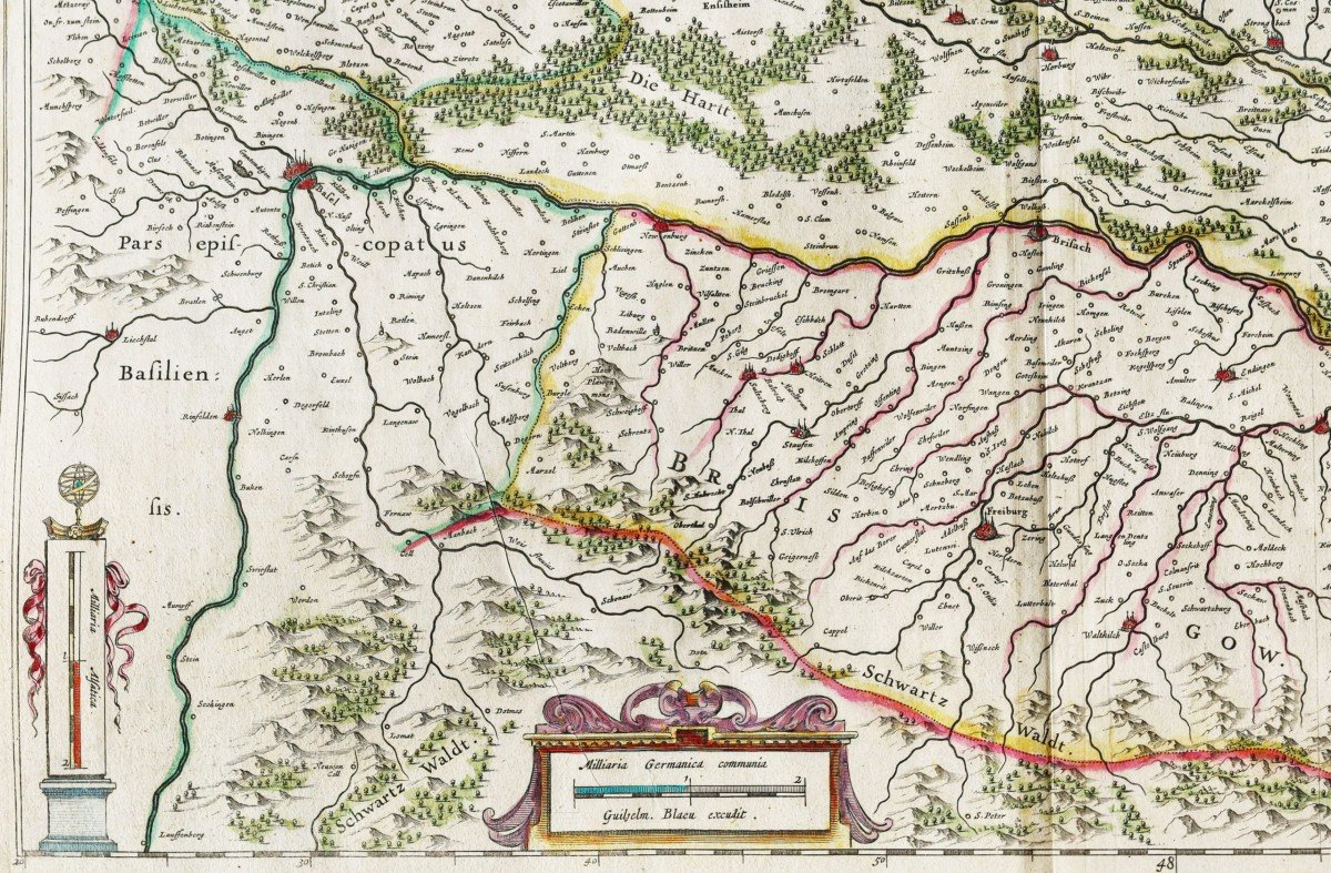
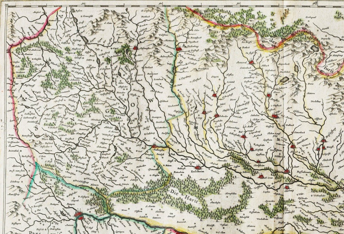

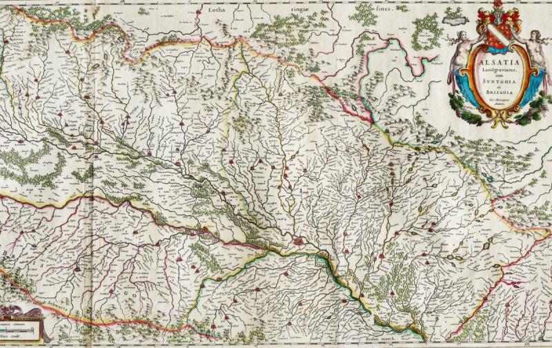
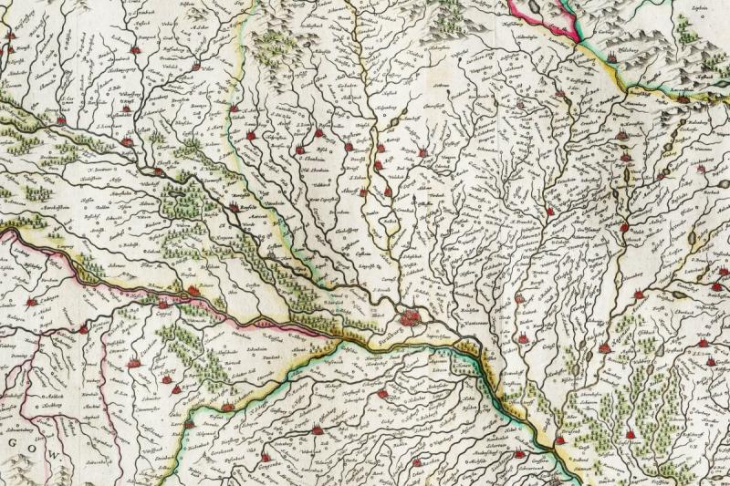
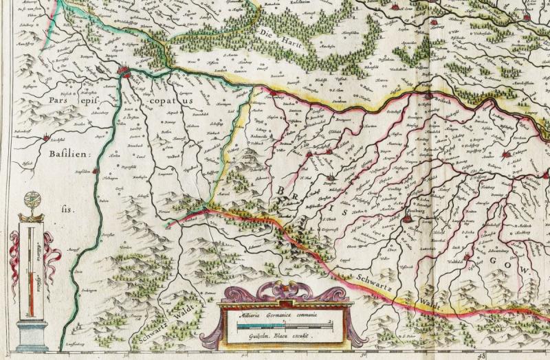
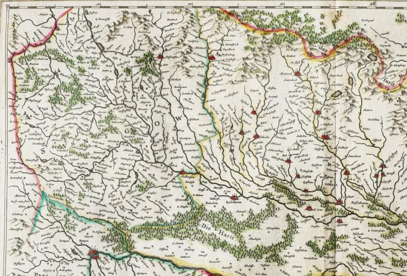
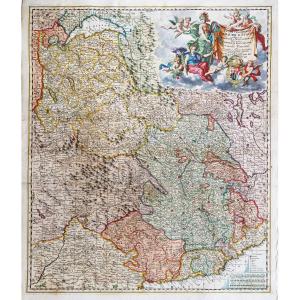
"Old Map Of Alsace And The Rhine"
Large original proof engraved on copper in 1642. Mercator cartographer. Blaeu editor.Beautiful old colors.
Explanatory text in Dutch on the back.
Sheet size: 83 x 47.5 cm.
Engraving format: 80 x 39.5 cm.
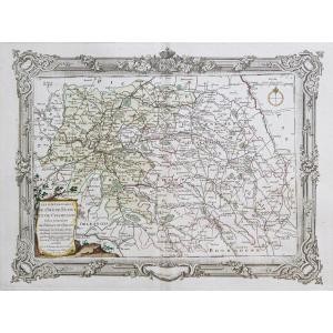
Original antique map of 1660.
One of the rare panoramic maps of the Blaeu edition in 2 attached sheets.
The course of the Rhine from Seltzer to the town of Bale.
Large decorative cartouche, scale of measurements.
You can consult all the maps, books and engravings available in your region by clicking on the link of our website specializing in ancient geographic archives: https://cartes-livres-anciens.com/produit/cartes-geographique-anciennes -original-antique-maps / europe / germany / carte-ancien-de-lalsace-et-du-rhin /
BLAEU At the beginning of the seventeenth century, Amsterdam was emerging as one of the most commercial cities in Europe, base of the Dutch East India Company, European banking and diamond trading center. Its inhabitants were distinguished by their intellectual skills and their exceptional know-how. In this auspicious period in the history of the northern provinces, Willem Janszoon Blaeu, born in Alkmaar in 1571 was trained in astronomy and science by Tycho Brahe, the famous Danish astronomer who founded a company in Amsterdam in 1599 to manufacture globes and scientific instruments. The business soon expanded, publishing maps, topographical works, nautical chart books and globes collections. His most notable early works are a map of Holland (1604), a beautiful map of the world (1605-06) and Het Licht der Zeevaerdt (The light of navigation), a marine atlas. At the same time, Blaeu was preparing a major atlas intended to include the most recent maps from all of the known world, but progress on such a large project remains slow, despite the expensive purchase of 40 brass cards from the Mercator edition as well as the background copperplate from the publication of maps of Jodocus Hondius. In 1630 a volume of 60 maps bearing the title Atlantis Annex was published. Five years passed before the publication of the first two volumes of his world atlas, Atlas Novus or the Theatrum Orbis Terrarum. At the same time, Blaeu was appointed hydrographer of the East India Company. In 1638 Blaeu died and the business passed into the hands of his sons, Joan and Cornelis, who continued and expanded their father's ambitious plans. After Cornelis' death, Joan ran the business alone and a 6-volume map collection was finally completed around 1655. Preparation for an even larger collection, Atlas Major, came into being and was published in 1662 in 9 volumes. then 11 volumes and finally 12 volumes for the edition with French text. This collection brought together nearly 600 double-page cards and 3000 explanatory texts on the back of the cards. It was and remains the most magnificent work ever of its kind; its geographic content may not have been as up-to-date or as accurate as its author would have liked, but any deficiency in this direction was more than made up for by the finesse of the engravings and their coloring, the elaborate cartouches, the pictorial details and heraldry in particular and the splendid calligraphy. In 1672, a fire destroyed Blaeu's printing press in the Gravenstraat and a year later Joan Blaeu died. The remaining card stocks were gradually dispersed. Some of the print coppers were purchased by the cartographers, F. de Wit, Schenk and Valck, before the final closure around 1695.It should be mentioned here that there is often confusion between the elder Blaeu and his rival Jan Jansson (Johannes Janssonius). Until 1619, Blaeu often signed his works Guilielmus Janssonius or Willems Jans Zoon, but after this period he seems to have opted for Guilielmus or G. Blaeu.
Secure payment by credit card on our website:https://cartes-livres-anciens.com/produit/cartes-geographiques-anciennes-original-antique-maps/europe/allemagne/carte-ancienne-de-lalsace-et-du-rhin/
All our maps and engravings are accompanied by a certificate of authenticity.


 Le Magazine
 Rivista Artiquariato
 TRÉSORS magazine