
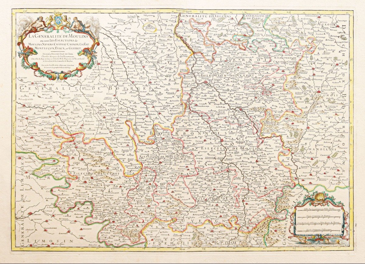
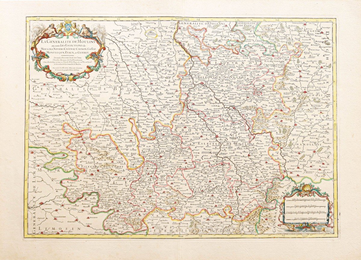
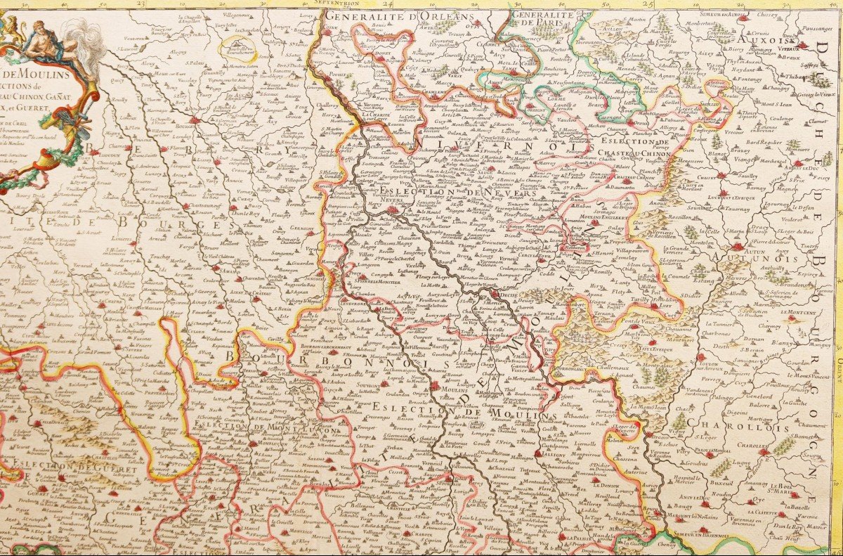
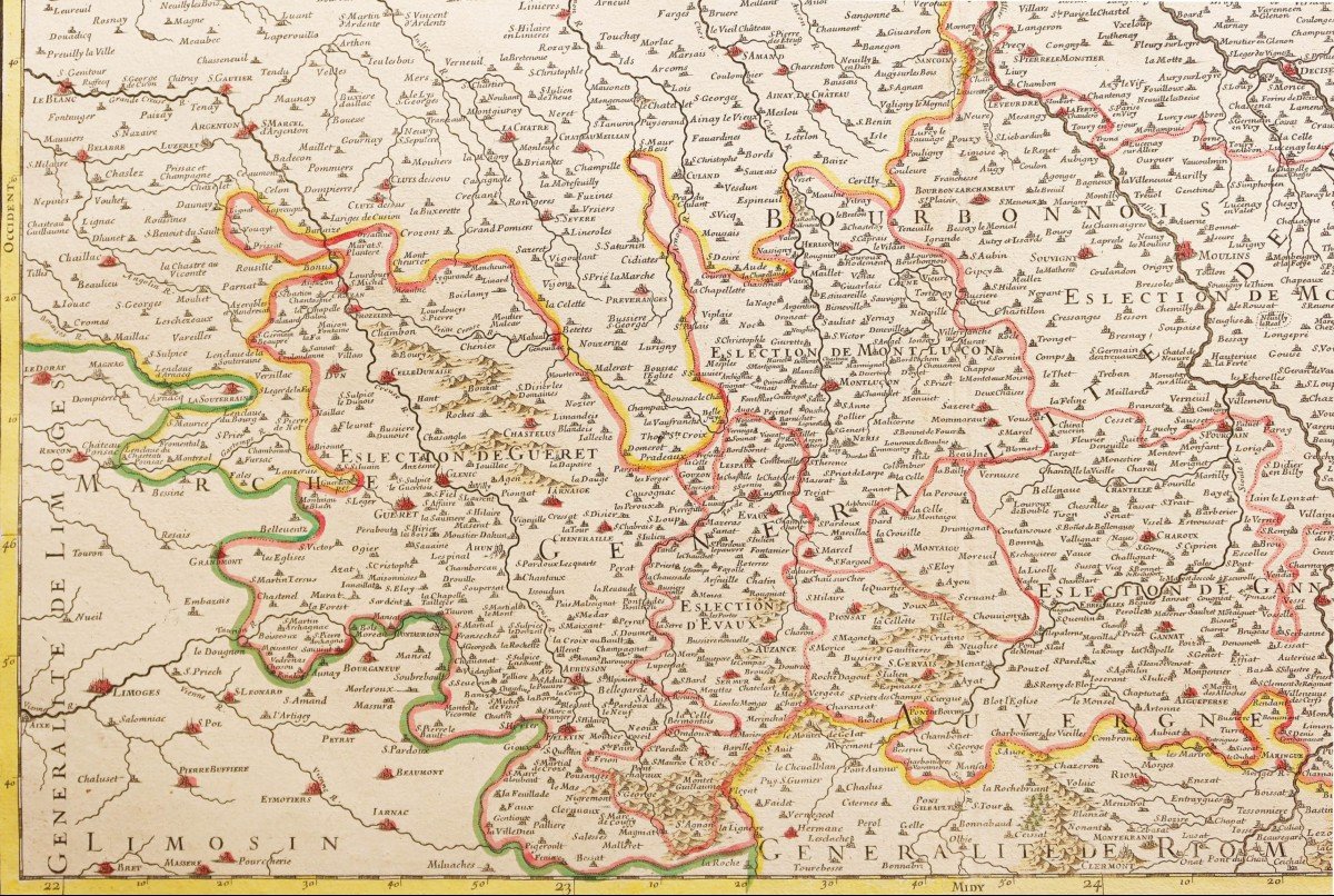

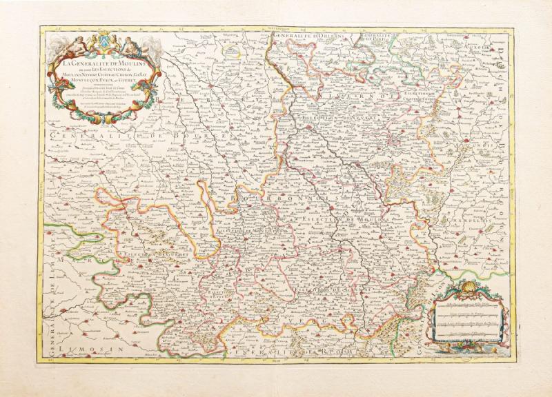
"Old Geographical Map Of Auvergne"
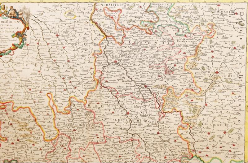
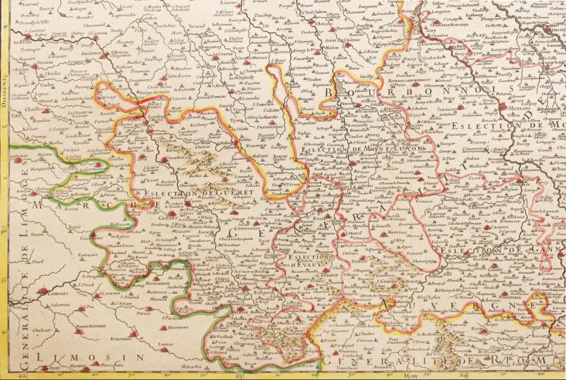
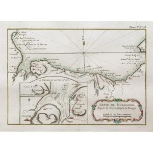
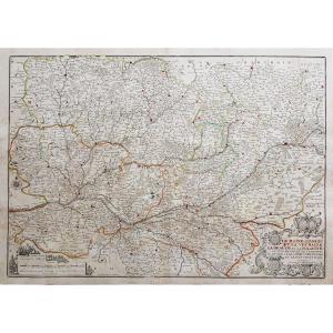
La Généralité de Moulins où sont les élections de Moulins, Nevers, Château-Chinon, Ganat, Mont Luçon, Evaux et Guéret.Epreuve originale réalisée vers 1720. Jaillot cartographe.
Limites colorées de l’époque.
Beaux coloris aquarelle.
Très bon état.
Format feuille: 76 x 55,5 cm.
Format gravure: 65,5 x 47 cm.
Original antique map around 1720.
Grande carte décorée d’un cartouche de titre et d’une échelle des mesures.
Vous pouvez consulter l’ensemble des cartes, livres et gravures disponibles sur votre région en cliquant sur le lien de notre site internet spécialisé en archives anciennes géographiques :
https://cartes-livres-anciens.com/categorie-produit/cartes-geographiques-anciennes-original-antique-maps/france/auvergne-limousin/
Règlement sécurisé par carte bancaire sur notre site internet:
https://cartes-livres-anciens.com/produit/cartes-geographiques-anciennes-original-antique-maps/france/auvergne-limousin/carte-geographique-ancienne-de-lauvergne-3/
Toutes nos cartes et gravures sont accompagnées d’un certificat d’authenticité.
The Generalitat of Moulins where are the elections of Moulins, Nevers, Château-Chinon, Ganat, Mont Luçon, Evaux and Guéret. Original proof made around 1720. Jaillot cartographer. Colored boundaries of the time. Beautiful watercolor colors. Very good state. Sheet size: 76 x 55.5 cm. Engraving format: 65.5 x 47 cm. Original antique map around 1720. Large map decorated with a title cartouche and a scale of measures. You can consult all the maps, books and engravings available in your region by clicking on the link of our website specializing in ancient geographic archives: https://cartes-livres-anciens.com/categorie-produit/cartes-geographique -anciennes-original-antique-maps / france / auvergne-limousin / Secure payment by credit card on our website: https://cartes-livres-anciens.com/produit/cartes-geographique-anciennes-original-antique-maps / france / auvergne-limousin / carte-geographique-ancien-de-lauvergne-3 / All our maps and engravings are accompanied by a certificate of authenticity.


 Le Magazine
 Rivista Artiquariato
 TRÉSORS magazine