
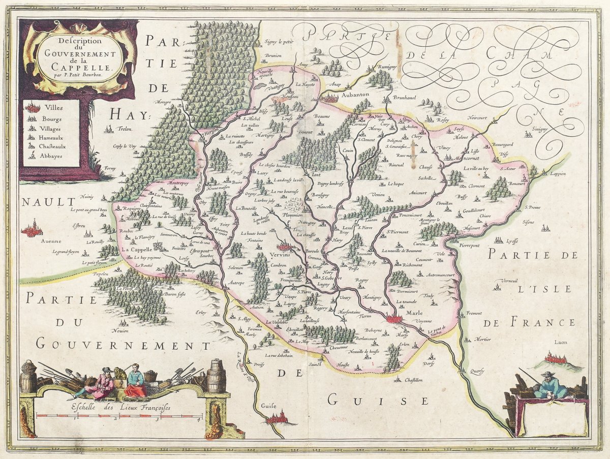
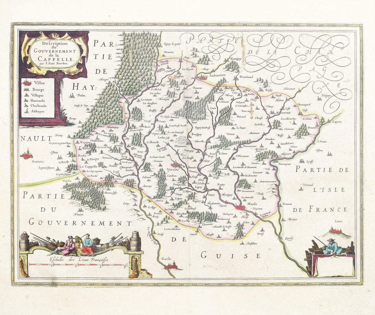
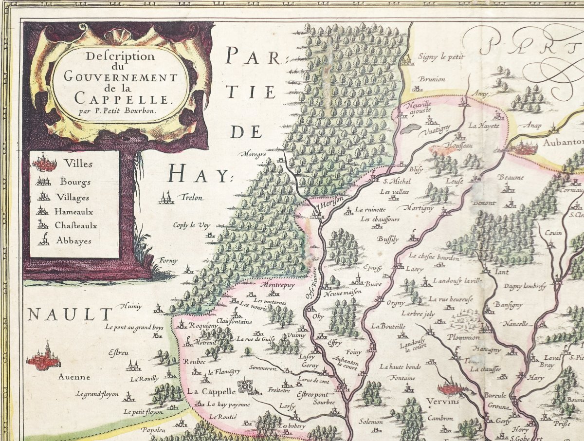

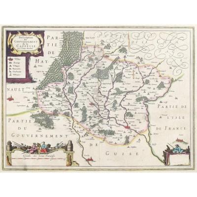


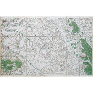
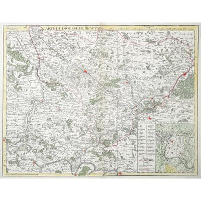
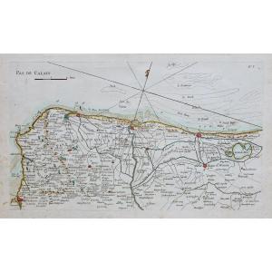
"Old Geographic Map Of The Government Of La Capelle"
Original proof engraved in 1638. Johannes Jansson cartographer.Very beautiful old colors.
Thin trace of friction and 2 traces of oxidation in the center of the card.
Explanatory text in Latin on the back.
Good condition.
Sheet size: 53 x 45 cm.
Engraving format: 50.5 x 38 cm.
Original antique map of 1638.
Particularly decorative map of the Vervins region. Large inset with signage of towns, villages and towns.
You can consult all the maps, books and engravings available in your region by clicking on the link of our website specializing in ancient geographic archives: https://www.cartes-livres-anciens.com
Secure payment by credit card on our website: https://cartes-livres-anciens.com/produit/cartes-geographique-anciennes-original-antique-maps/france/picardie-oise/carte-geographique-ancienne-du-gouvernement-de-la- capelle /
Johannes Janssonius, better known as Jan Jansson, was born in Arnhem, where his father was a bookseller and publisher (Jan Janszoon the Elder). In 1612 he married the daughter of cartographer and publisher Jodocus Hondius, then moved to Amsterdam as a book publisher. In 1616, he published his first maps of France and Italy and from then on produced a very large number of maps, quite comparable to those of the Blaeu family, because very close in quantity and quality. From around 1630 to 1638, he associated with his brother-in-law, Henricus Hondius, and published new editions of the Mercator / Hondius atlases with which he was associated. On Henricus' death, he took over the business, further expanding the atlas until he finally published an 11-volume Atlas Major on a scale similar to that of Blaeu's Atlas Major. In general, Jansson's cards look a lot like Blaeu's and, in fact, were often copied from it, but they tend to be more flamboyant and, according to some, more decorative. After Jansson's death his heirs published a number of maps in an Atlas Contractus in 1666 and still later many plates of his British maps were acquired by Pieter Schenk and Gerard Valck, who published them again in 1683 as of separate cards.
Epreuve originale gravée en 1638. Johannes Jansson cartographe.
Très beaux coloris anciens.
Fine trace de frottement et 2 traces d’oxydation dans le centre de la carte.
Texte explicatif en latin au verso.
Bon état.
Format feuille: 53 x 45 cm.
Format gravure: 50,5 x 38 cm.
Original antique map of 1638.
Carte particulièrement décorative de la région de Vervins. Large cartouche avec signalétique des villes, bourgs et villages.
Vous pouvez consulter l’ensemble des cartes, livres et gravures disponibles sur votre région en cliquant sur le lien de notre site internet spécialisé en archives anciennes géographiques :https://www.cartes-livres-anciens.com
Règlement sécurisé par carte bancaire sur notre site internet: https://cartes-livres-anciens.com/produit/cartes-geographiques-anciennes-original-antique-maps/france/picardie-oise/carte-geographique-ancienne-du-gouvernement-de-la-capelle/
Johannes Janssonius, plus connu sous le nom de Jan Jansson, est né à Arnhem, où son père était libraire et éditeur (Jan Janszoon the Elder).
En 1612, il épousa la fille du cartographe et éditeur Jodocus Hondius, puis s’installa à Amsterdam en tant qu’éditeur de livres. En 1616, il publie ses premières cartes de France et d’Italie et produit à partir de ce moment un très grand nombre de cartes, tout à fait comparables à celles de la famille Blaeu, car très proches en quantité et en qualité.
De 1630 à 1638 environ, il s’associa à son beau-frère, Henricus Hondius, et publia de nouvelles éditions des atlas Mercator / Hondius auxquels il fut associé. À la mort de Henricus, il reprit l’entreprise, élargissant encore l’atlas jusqu’à ce qu’il publie finalement un Atlas Major en 11 volumes à une échelle similaire à celle de l’Atlas Major de Blaeu.
En général, les cartes de Jansson ressemblent beaucoup à celles de Blaeu et, en fait, elles en ont souvent été copiées, mais elles ont tendance à être plus flamboyantes et, selon certains, plus décoratives. Après la mort de Jansson, ses héritiers publièrent un certain nombre de cartes dans un Atlas Contractus en 1666 et plus tard encore, de nombreuses plaques de ses cartes britanniques furent acquises par Pieter Schenk et Gerard Valck, qui les publièrent à nouveau en 1683 sous forme de cartes séparées.


 Le Magazine
 Rivista Artiquariato
 TRÉSORS magazine