


"Book General General Cards Costes France Tassin 1634 Vanlochom"
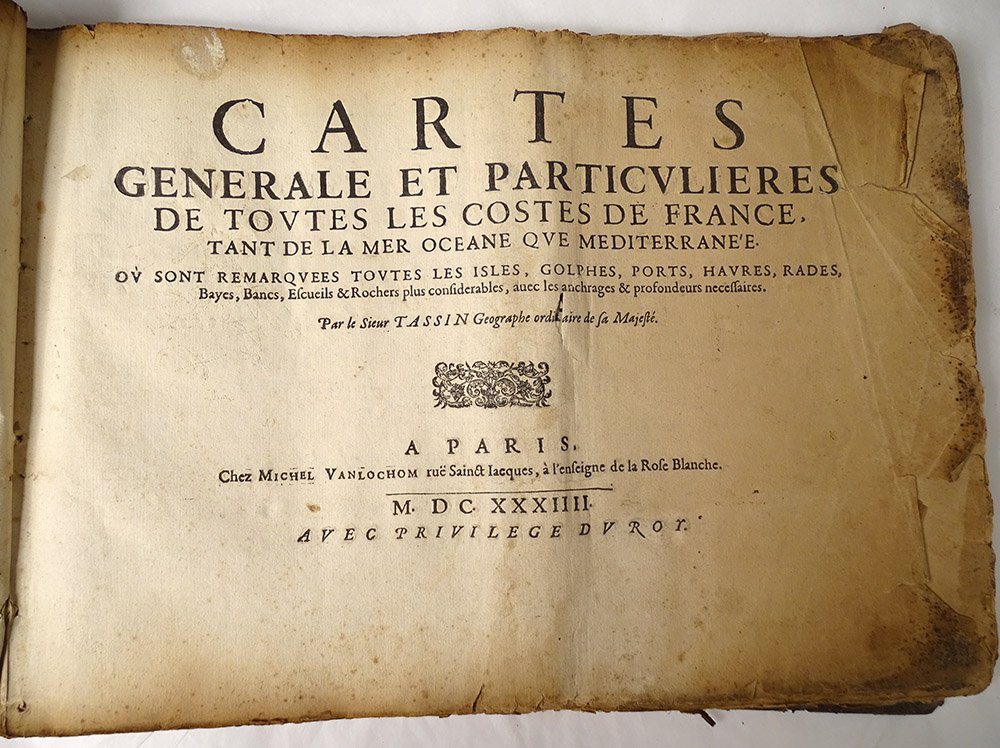
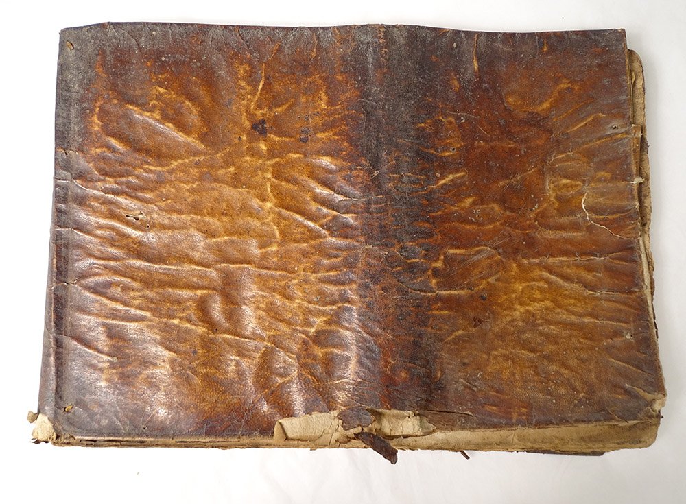
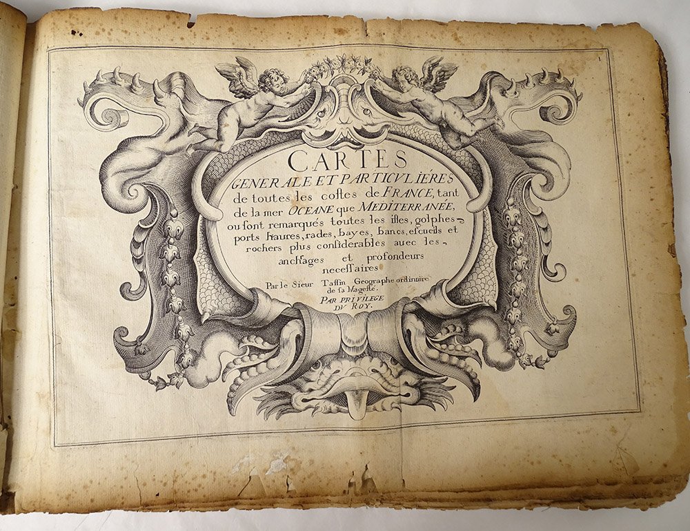
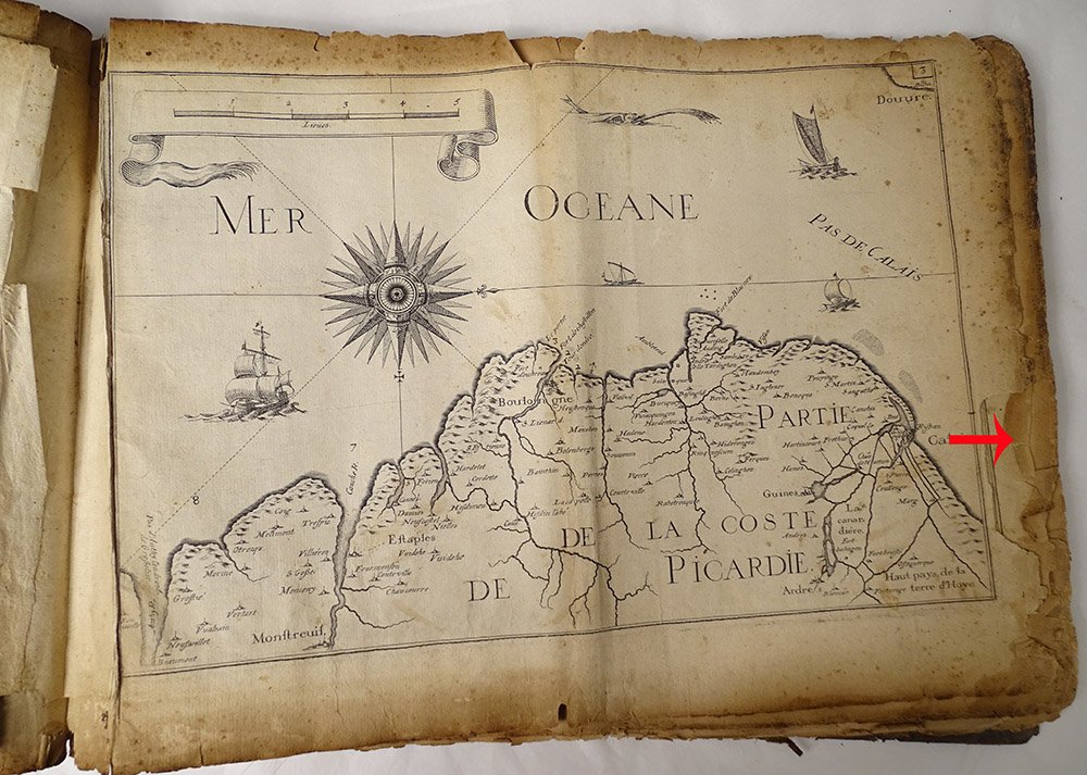
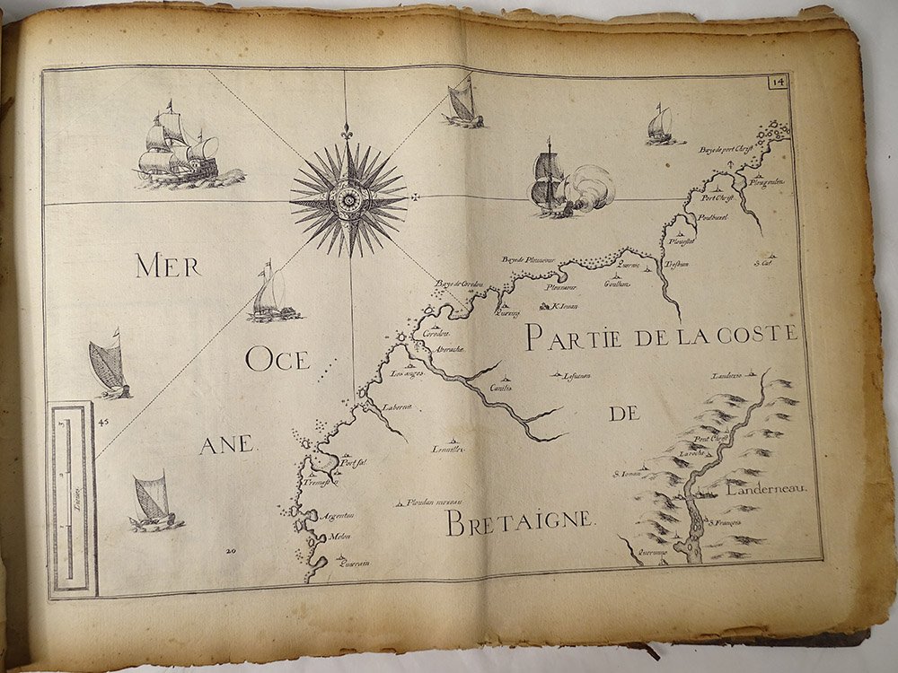
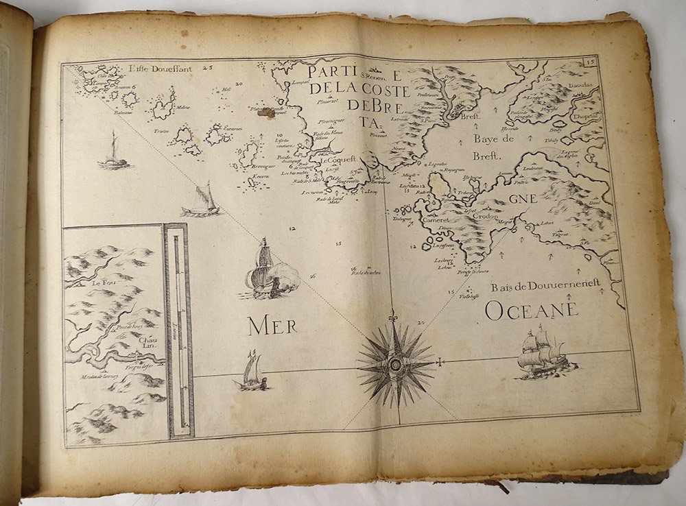
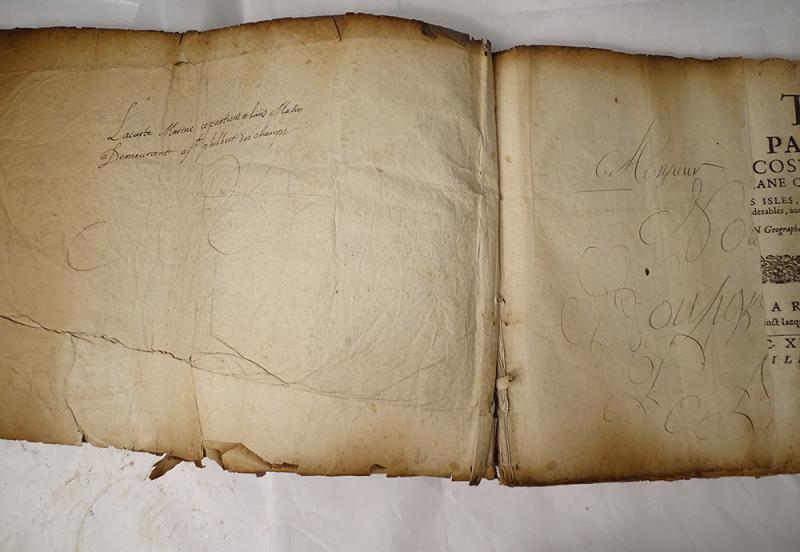
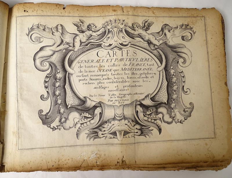
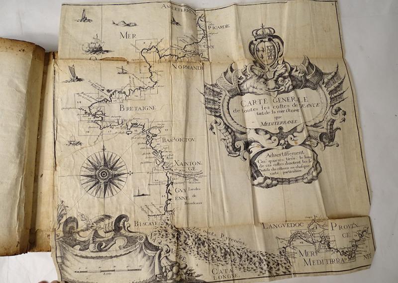
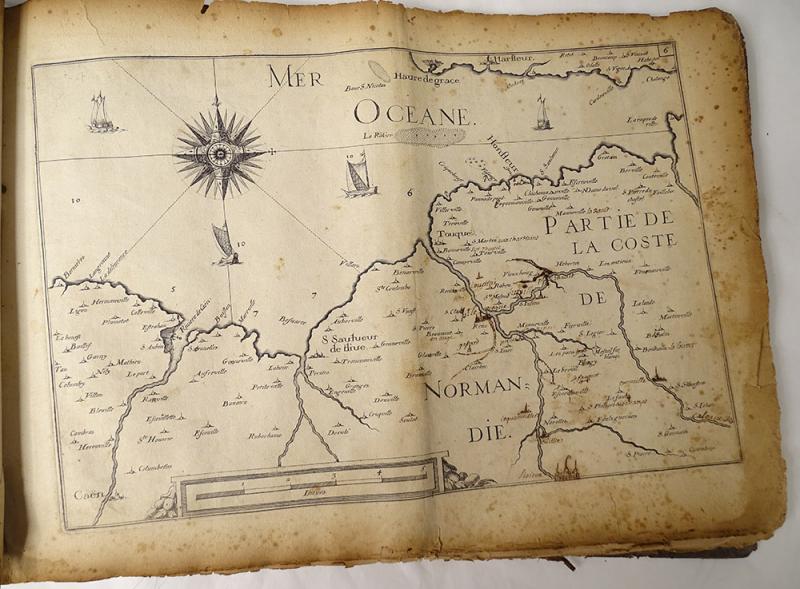
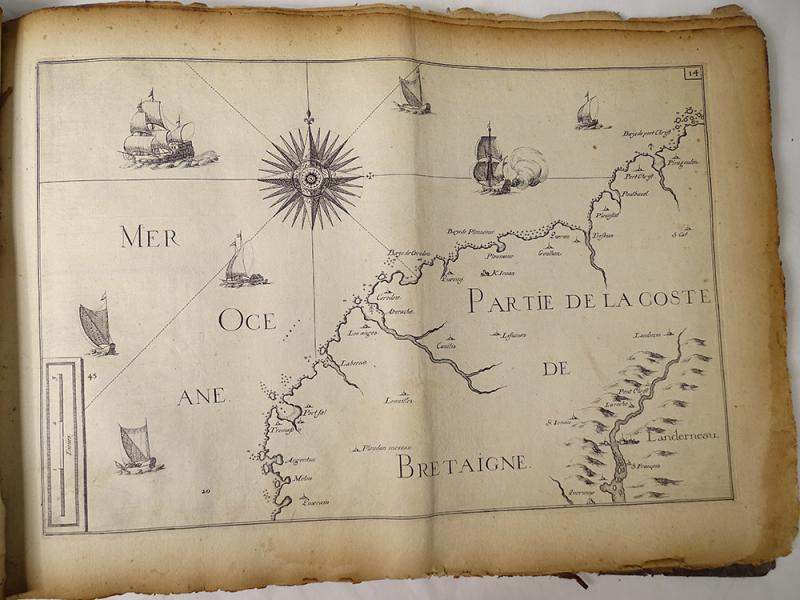
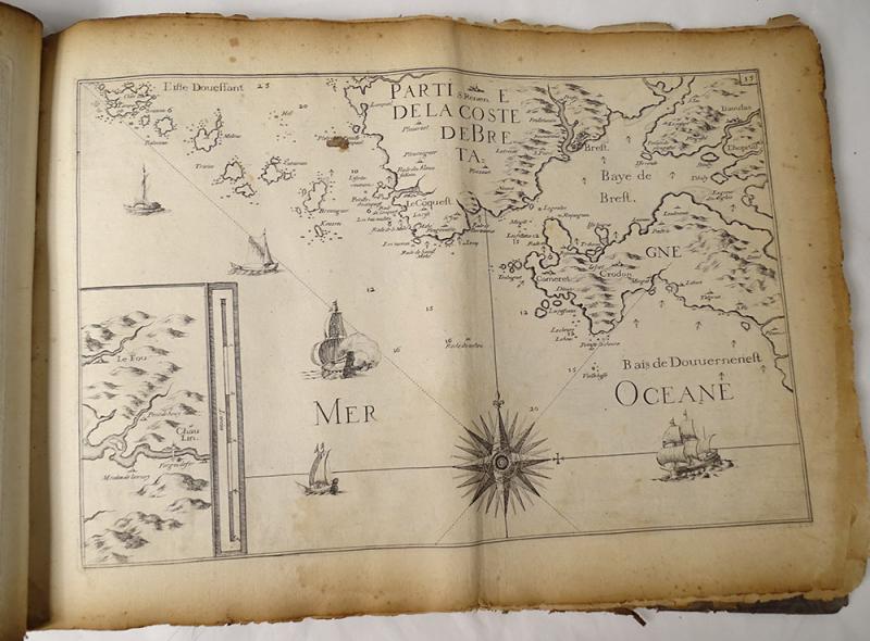
Book titled "General and Particular Maps of All Costes of France, Both of the Ocean and the Mediterranean Sea" by Sieur Tassin *, Geographer of his Majesty, In Paris Chez Michel Vanlochom Rue Saint Jacques, 1634 with Roy's privilege. Period 17th century. This book is in its juice, has undergone the uses of time. High quality. Vellum cover (soft). This book has been folded in half (cover and pages slightly curled in the middle). It misses the card numbered 12 and 29, the card 16 is largely torn at the bottom (missing lower right corner). A note: stains, tears and wear of time on the vellum and the inner pages (especially on the outer edges of the pages), look at the photos. The 29 cards were intended to facilitate coastal defense at the height of the Thirty Years' War. The first part traces the Atlantic coast from Calais to San Sebastian, the second the Mediterranean coast from the Spanish border to Villefranche. * Christophe Nicolas Tassin born in the early 1600s and died in 1660, in France, also known as Nicolas Tassin, Christophe Nicolas Tassin or Christophe Le Tassin, French cartographer, known for his atlas of France, Spain, the 'Germany and Switzerland. Most of his work was published in Paris from 1633 to 1635. His colleagues include Melchior Tavernier (1594-1665), Sébastien Cramoisy (1584-1669) and Michael van Lochum (1601-1647). Dimensions Dimensions 40 cm x 28 cm Reference: F10 65 All photos are on: www.antiques-delaval.com 


 Le Magazine
 Rivista Artiquariato
 TRÉSORS magazine