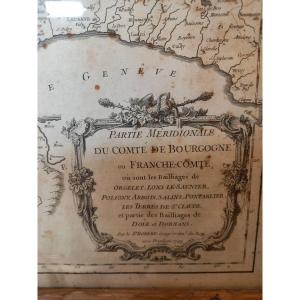
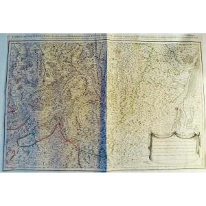
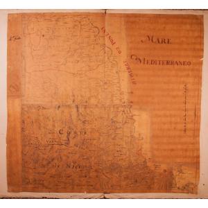
Large map dated 1749 drawn up by Mr. Robert, ordinary geographer of the King, representing in two sheets in folio assembled in a frame Franche-Comté and its various bailiwicks. Interesting topographic[...]
[MAP] - JAILLOT - Les Prévotez, offices, senehaussee and county, which are part of the bailiwicks of Vosge or Mirecourt and Nancy, in the duchy of Lorraine, the adjacent lands of Épinal, Chaté and the[...]
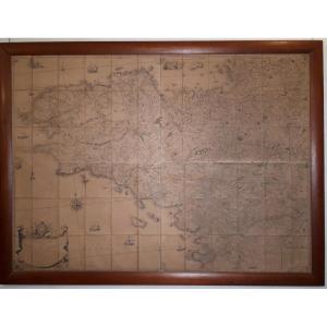
Beautiful large plan of Quesnoy, stronghold of Heinaut fortified since 11th century, taken and recaptured, on heart Louis XIV and Louis XV wars. Louis XV period work, 18th century (scale 200 toises, L[...]
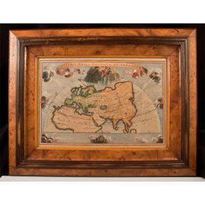
18th century engraving Veteris Orbis Climata Ex Strabone Walnut burr frame dimensions 46.8 cm x 36.7 cm View 32 cm x 22 cm Very good condition. Price nonnegotiable. Payment by check or bank transfer. [...]
Joseph Roux (1725-1789) Hydrographe du Roy
Recueil des principaux plans des ports et rades de la mer Méditerranée
Edition de 1764, contient 120 planches (manque La lagune de Venise)
Quelques traçes[...]
Important map of Brittany made by the engineer geographer Jean-Baptiste Ogée (1728-1789) and engraved by Nion in 1771.
It was on a copy of this map that the Breton deputies, on February 26, 1790, d[...]
Rare map of the Riviera / Côte d'Azur around 1740-1750, including among others: Juan les Pins, Antibes, Cagnes, Nice, St-Jean-Cap-Ferrat, Monaco, Menton, Ventimiglia, Bordighera, San Remo.
Pen, black[...]
Map of the Northern Crowns
including Sweden, Denmark, and C. dedicated to his Majesty, the King of Sweden, of the Gots and the Vandals
by Guillaume Delisle, 1st geographer of the King, of the Royal [...]
18th century maritime map.
Particular map of the Côtes de Bretagne from the Goulven cove to the Isle of Ouessant, probably by Le Rouge.
Dimensions: 58 x 80.3 cm 22.83 x 31.61 inches in the line
[...]
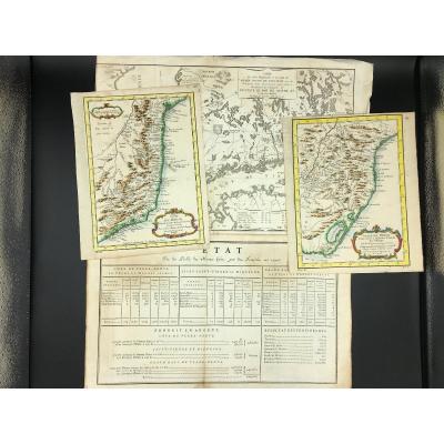
3 geographical maps including 2 of Brazil and 1 of Finland plus 1 on the state of cod fishing from the 18th century. The 2 maps of Brazil are period colored and were engraved by Danville. Dimensions h[...]
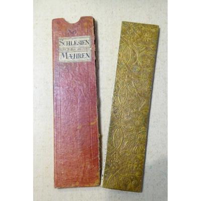
Old small travel map engraved on copper and watercolored, signed by Johann George Schreiber (1676-1750). - It folds up into a portfolio with embossed gold paper edges, and fits into its red paper case[...]
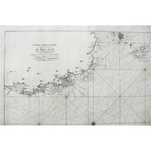
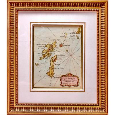
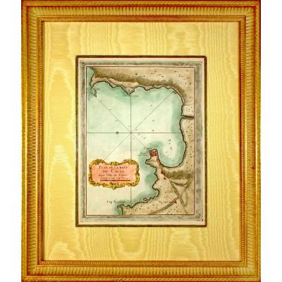
Original steel engraving with a chisel and laid paper with watermark. Engraved by BELLIN Jacques Nicolas, (French -1703-1772). Cartographer and hydrographer. In 1721, he was appointed hydrographer of [...]
PLAN OF THE BAYE DE CALVI in the Isle of Corsica RARE nautical chart Original steel engraving with a chisel and laid paper with watermark. Engraved by BELLIN Jacques Nicolas, (French -1703-1772). Cart[...]
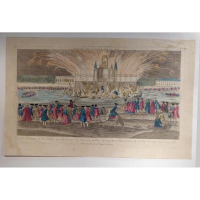
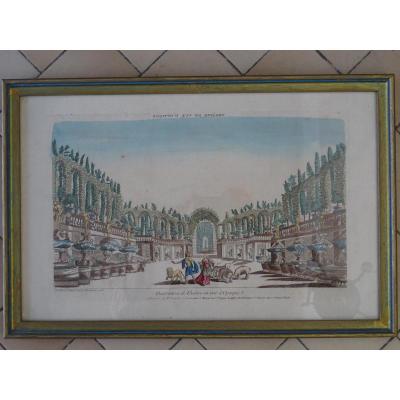
I take again the title of the one of the National Library of France: View of the Fireworks fire drawn on the water / Perspective view of the Fireworks that must be shot on the Water near the Place of [...]
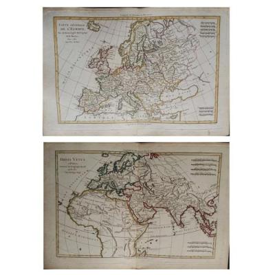
Paire de cartes de l'Europe
XVIIIème siècle
Cartographe R. Bonne "Orbis Vetus",
Le monde dans l'antiquité Avril 1781
Gravure sur cuivre Image 32 x 21 cm
Page complète: 37.5 x 26.5 cm
Cartog[...]
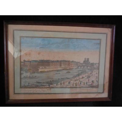
Optical view, (under glass) engraved print depicting the Saint Louis island and Tournelle bridge in Paris, eighteenth time Marie-louise and baguette frame in good general condition spot on the marie -[...]
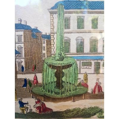
optical view showing the Theater of Marcellus in Rome. Eighteenth time. Supervision and pass-modern view of good quality. P France 10 euros. Payment by French check, bank transfer or Paypal
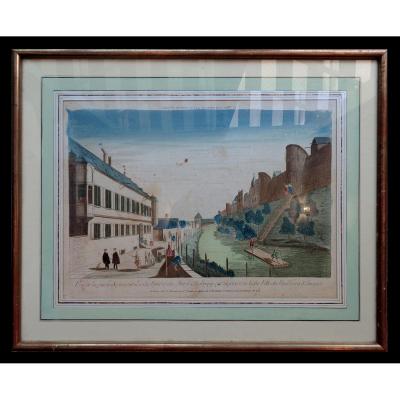
to 18 ° optical view of Augsburg since ditches optical view of the eighteenth to the northern part of the moat and walls of Augsburg which separate the lower town of the Faubourg St. Jacques in Paris [...]
Proantic uses a cookie to analyze traffic and improve its service by using Google Analytics. Data sent to Google Analytics (frequency of visits to the site and pages visited) are anonymous. No other cookie tracks your activity, your personal data is not collected. Thank you for helping us to have better understanding how Proantic is used.


 Le Magazine
 Rivista Artiquariato
 TRÉSORS magazine


